Sant Martí de Provençals
Appearance
Sant Martí de Provençals | |
|---|---|
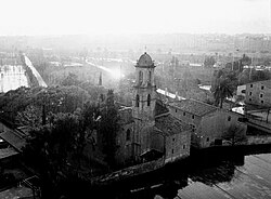
 Sant Martí church | |
 | |
| Country | |
| Autonomous Community | |
| Province | |
| Comarca | Barcelonès |
| Municipality | |
| District | Sant Martí |
| Population (2016) | |
| • Total | 26,010 |
Sant Martí de Provençals is a neighborhood in the Sant Martí district of Barcelona, Catalonia (Spain).
Sant Martí de Provençals was the center of the eponymous former municipality, which now more or less coincides with the current district of Sant Martí and which gave its name to the main core of the town. Until the 1950s the area was occupied by fields, country houses and the church of Sant Martí. The population of the district later increased due to the arrival of migratory waves.
