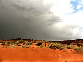
Sand Hollow State Park
Appearance
| Sand Hollow State Park | |
|---|---|
IUCN category V (protected landscape/seascape) | |
 Red Mountain in Sand Hollow State Park | |
| Location | Washington County, Utah, United States |
| Coordinates | 37°6′56″N 113°22′35″W / 37.11556°N 113.37639°W |
| Area | 20,611 acres (83.41 km2)[1] |
| Elevation | 3,000 ft (910 m)[2] |
| Established | 2003[2] |
| Visitors | 1,089,087 (in 2022)[3] |
| Operator | Utah State Parks |
Sand Hollow State Park is a state park located in Utah, USA, featuring a 1,322-acre (535 ha) reservoir and an extensive off highway vehicle recreation area on Sand Mountain. The park is near the town of Hurricane.
The park was officially dedicated in April 2003 and surrounds the Sand Hollow Reservoir. Sand Hollow quickly became a popular site for camping, fishing, boating, and ATV riding on nearby sand dunes.
References
[edit]- ^ "Sand Hollow State Park Resource Management Plan" (PDF). Utah State Parks. April 2010. Retrieved February 10, 2011.
- ^ a b "Sand Hollow State Park: About the Park". Utah State Parks. Archived from the original on March 16, 2011. Retrieved February 10, 2011.
- ^ "Park Visitation Data". Utah State Parks. July 6, 2023.


