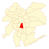
San Miguel, Chile
San Miguel | |
|---|---|
|
| |
| Coordinates (alcalde's office): 33°29′09″S 70°38′58″W / 33.48583°S 70.64944°W | |
| Country | Chile |
| Region | Santiago Metro. |
| Province | Santiago |
| Founded | 10 August 1896 |
| Government | |
| • Type | Municipality |
| • Alcalde | Luis Sanhueza Bravo |
| Area | |
• Total | 9.5 km2 (3.7 sq mi) |
| As of 2002 Census | |
| Population (2017 projection)[3] | |
• Total | 107,954 |
| • Density | 11,000/km2 (29,000/sq mi) |
| • Urban | 107,954 |
| • Rural | 0 |
| Demonym | Sanmiguelino |
| Sex | |
| • Men | 37,836 |
| • Women | 41,036 |
| Time zone | UTC-4 (CLT[4]) |
| • Summer (DST) | UTC-3 (CLST[5]) |
| Area code | 56 + |
| Website | Municipality of San Miguel |
San Miguel (Spanish for "Saint Michael") is a commune of Chile located in Santiago Province, Santiago Metropolitan Region. It was founded on August 10, 1896.
Administration
[edit]As a commune, San Miguel is a third-level administrative division of Chile administered by a municipal council, headed by an alcalde who is directly elected every four years. The alcalde's office (alcaldía) is located at Gran Avenida No. 3418. The 2012–2016 alcalde is Julio Palestro Velásquez (PS). The communal council has the following members:
- Francia Palestro Contreras (PS)
- Luis Sanhueza Bravo (RN)
- Erika Martinez Osorio (PC)
- Carolina Onofri Salinas (RN)
- David Navarro Carachi (PRSD)
- Felipe Von Unger Valdés (UDI)
- Rodrigo Iturra Becerra (PDC)
- Ernesto Balcázar Gamboa (PS)
San Miguel belongs to the 28th electoral division (together with Pedro Aguirre Cerda and Lo Espejo) and the 8th senatorial constituency (Santiago East). It is represented in the Chamber of Deputies of the National Congress by the deputies Guillermo Teillier del Valle (PCCh) and Pedro Browne Urrejola (RN). It is represented in the Senate by senators Soledad Alvear (PDC) and Pablo Longueira (UDI).
Demographics
[edit]According to the 2002 census of the National Statistics Institute, San Miguel spans an area of 9.5 km2 (4 sq mi) and has 78,872 inhabitants (37,836 men and 41,036 women), and the commune is an entirely urban area. The population fell by 4.8% (3997 persons) between the 1992 and 2002 censuses.[3] The demonym for a person from San Miguel is sanmiguelino for a man or sanmiguelina for a woman.
- Other statistics
- Average annual household income: US$39,670 (PPP, 2006)[6][failed verification]
- Population below poverty line: 2.5% (2006)[7]
- Regional quality of life index: 82.17, high, 6 out of 52 (2005)[citation needed]
- Human Development Index: 0.765, 31 out of 341 (2003)[8]
Notable sanmiguelinos
[edit]
References
[edit]- ^ "Municipality of San Miguel" (in Spanish). Retrieved 14 September 2010.
- ^ "Administrative and Censual Political Division" (PDF) (in Spanish). Retrieved 13 September 2010.
- ^ a b c d "National Statistics Institute" (in Spanish). Retrieved 8 September 2010.
- ^ "Chile Time". WorldTimeZones.org. Archived from the original on 2007-09-11. Retrieved 2010-07-29.
- ^ "Chile Summer Time". WorldTimeZones.org. Archived from the original on 2007-09-11. Retrieved 2010-07-29.
- ^ "Regional Information System". Ministry of Planning of Chile (in Spanish). Archived from the original on 23 April 2008. Retrieved 14 September 2010.
- ^ "Poverty in the Santiago Metropolitan Region" (PDF). Ministry of Planning of Chile (in Spanish). Archived from the original (PDF) on August 24, 2007.
- ^ "The Trajectories of Human Development in the Communes of Chile (1994-2003)" (PDF). Government of Chile, Mideplán (in Spanish). UNDP. Archived from the original (PDF) on 7 July 2011. Retrieved 12 September 2010.
External links
[edit]- (in Spanish) Municipality of San Miguel


