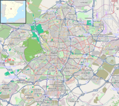
San Fermín-Orcasur (Madrid Metro)
Appearance
| Madrid Metro station | |||||||||||
 | |||||||||||
| General information | |||||||||||
| Location | Usera, Madrid Spain | ||||||||||
| Coordinates | 40°22′12″N 3°41′39″W / 40.3699938°N 3.6941721°W | ||||||||||
| Owned by | CRTM | ||||||||||
| Operated by | CRTM | ||||||||||
| Construction | |||||||||||
| Structure type | Underground | ||||||||||
| Accessible | Yes | ||||||||||
| Other information | |||||||||||
| Fare zone | A | ||||||||||
| History | |||||||||||
| Opened | 21 April 2007 | ||||||||||
| Services | |||||||||||
| |||||||||||
| |||||||||||
San Fermín-Orcasur [ˈsaɱ feɾˈmin oɾkaˈsuɾ] is a station on Line 3 of the Madrid Metro, serving the barrios of San Fermín and Orcasur. It is located in fare Zone A.[1]
References
[edit]Wikimedia Commons has media related to Estación de San Fermín-Orcasur.

