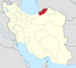
Sadan Rostaq-e Gharbi Rural District
Appearance
Sadan Rostaq-e Gharbi Rural District
Persian: دهستان سدن رستاق غربي | |
|---|---|
| Coordinates: 36°47′06″N 54°10′15″E / 36.78500°N 54.17083°E[1] | |
| Country | Iran |
| Province | Golestan |
| County | Kordkuy |
| District | Central |
| Capital | Chahar Deh |
| Population (2016)[2] | |
• Total | 10,681 |
| Time zone | UTC+3:30 (IRST) |
Sadan Rostaq-e Gharbi Rural District (Persian: دهستان سدن رستاق غربي) is in the Central District of Kordkuy County, Golestan province, Iran. Its capital is the village of Chahar Deh.[3]
Demographics
[edit]Population
[edit]At the time of the 2006 National Census, the rural district's population was 11,165 in 3,072 households.[4] There were 10,862 inhabitants in 3,395 households at the following census of 2011.[5] The 2016 census measured the population of the rural district as 10,681 in 3,690 households. The most populous of its nine villages was Bala Jaddeh, with 3,604 people.[2]
See also
[edit]References
[edit]- ^ OpenStreetMap contributors (17 October 2024). "Sadan Rostaq-e Gharbi Rural District (Kordkuy County)" (Map). OpenStreetMap (in Persian). Retrieved 17 October 2024.
- ^ a b Census of the Islamic Republic of Iran, 1395 (2016): Golestan Province. amar.org.ir (Report) (in Persian). The Statistical Center of Iran. Archived from the original (Excel) on 29 March 2019. Retrieved 19 December 2022.
- ^ Mousavi, Mirhossein (c. 2024) [4 October 1366]. Creation and establishment of four rural districts including villages, farms and places in Kordkuy County under Mazandaran province. lamtakam.com (Report) (in Persian). Ministry of the Interior, Council of Ministers. Notification 1364.33.1.5.53. Archived from the original on 14 February 2024. Retrieved 14 February 2024 – via Lam ta Kam.
- ^ Census of the Islamic Republic of Iran, 1385 (2006): Golestan Province. amar.org.ir (Report) (in Persian). The Statistical Center of Iran. Archived from the original (Excel) on 20 September 2011. Retrieved 25 September 2022.
- ^ Census of the Islamic Republic of Iran, 1390 (2011): Golestan Province. irandataportal.syr.edu (Report) (in Persian). The Statistical Center of Iran. Archived from the original (Excel) on 17 January 2023. Retrieved 19 December 2022 – via Iran Data Portal, Syracuse University.


