São Borja Airport
Appearance
São Borja Airport Aeroporto de São Borja | |||||||||||||||
|---|---|---|---|---|---|---|---|---|---|---|---|---|---|---|---|
 | |||||||||||||||
| Summary | |||||||||||||||
| Airport type | Public | ||||||||||||||
| Serves | São Borja | ||||||||||||||
| Time zone | BRT (UTC−03:00) | ||||||||||||||
| Elevation AMSL | 80 m / 262 ft | ||||||||||||||
| Coordinates | 28°39′17″S 056°02′05″W / 28.65472°S 56.03472°W | ||||||||||||||
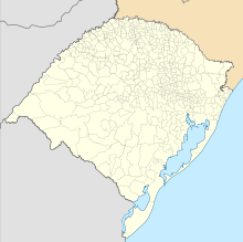
| Map | |||||||||||||||
 | |||||||||||||||
| Runways | |||||||||||||||
| |||||||||||||||
São Borja Airport (IATA: JBS, ICAO: SSSB), also known as João Manoel Airport, is the airport serving São Borja, located in the Rio Grande do Sul state of Brazil.
Airlines and destinations
[edit]No scheduled flights operate at this airport.
Accidents and incidents
[edit]- 30 June 1950: a SAVAG Lockheed Model 18 Lodestar registration PP-SAA flying from Porto Alegre to São Borja in bad weather collided against a hill, caught fire and crashed near the location of São Francisco de Assis. All 10 occupants died, including the founder of SAVAG and pilot, Gustavo Kraemer, and Joaquim Pedro Salgado Filho, senator and first Minister of Air Force in Brazil.[3][4]
Access
[edit]The airport is located 4 km (2 mi) from downtown São Borja.
See also
[edit]References
[edit]- ^ "Aeródromos". ANAC (in Portuguese). 29 June 2020. Retrieved 22 March 2021.
- ^ "São Borja (SSSB)". DECEA (in Portuguese). Retrieved 27 September 2023.
- ^ "Accident description PP-SAA". Aviation Safety Network. Retrieved 20 July 2013.
- ^ Germano da Silva, Carlos Ari César (2008). "Salgado Filho". O rastro da bruxa: história da aviação comercial brasileira no século XX através dos seus acidentes 1928-1996 (in Portuguese) (2 ed.). Porto Alegre: EDIPUCRS. pp. 102–107. ISBN 978-85-7430-760-2.
External links
[edit]- Airport information for SSSB at Great Circle Mapper. Source: DAFIF (effective October 2006).
- Current weather for SSSB at NOAA/NWS
- Accident history for SSSB at Aviation Safety Network


