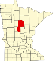
Ryan Village, Minnesota
Appearance
Ryan Village | |
|---|---|
| Coordinates: 47°21′32″N 94°17′21″W / 47.35889°N 94.28917°W | |
| Country | United States |
| State | Minnesota |
| County | Cass |
| Elevation | 1,319 ft (402 m) |
| Time zone | UTC-6 (Central (CST)) |
| • Summer (DST) | UTC-5 (CDT) |
| ZIP code | 56626 |
| Area code | 218 |
| GNIS feature ID | 658123[1] |
Ryan Village is an unincorporated community in Cass County, Minnesota, United States, within the Bowstring State Forest and the Chippewa National Forest. It is located between Cass Lake and Bena along U.S. Highway 2. The village is within the Leech Lake Indian Reservation.
References
[edit]


