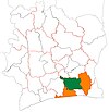
Rubino, Ivory Coast
Appearance
Rubino | |
|---|---|
Town, sub-prefecture, and commune | |
| Coordinates: 6°4′N 4°19′W / 6.067°N 4.317°W | |
| Country | |
| District | Lagunes |
| Region | Agnéby-Tiassa |
| Department | Agboville |
| Area | |
| • Total | 506 km2 (195 sq mi) |
| Population (2021 census)[2] | |
| • Total | 32,775 |
| • Density | 65/km2 (170/sq mi) |
| • Town | 14,025[1] |
| (2014 census) | |
| Time zone | UTC+0 (GMT) |
Rubino is a town in southeastern Ivory Coast. It is a sub-prefecture and commune of Agboville Department in Agnéby-Tiassa Region, Lagunes District.
In 2021, the population of the sub-prefecture of Rubino was 32,775.[2]
Villages
[edit]The 12 villages of the sub-prefecture of Rubino and their population in 2014 are:[3]
- Adomokro (1 850)
- Dey-Oboguié (920)
- Kamabrou (797)
- Rubino (14 025)
- Ségbévi (573)
- Allany (4 575)
- Amangbeu (4 322)
- Brou-M'po (786)
- Gouabo (2 224)
- Kédjé-M'po (730)
- Kotchi-M'po (2 910)
- Ouélézoué (1 841)
References
[edit]- ^ Citypopulation.de Population of cities & localities in Ivory Coast
- ^ a b Citypopulation.de Population of the regions and sub-prefectures of Ivory Coast
- ^ Citypopulation.de Population of the localities in the sub-prefecture of Rubino


