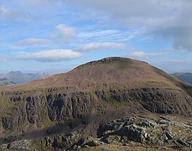
Ruadh Stac Mor
Appearance
| Ruadh Stac Mor | |
|---|---|
| An Ruadh-Stac Mòr | |
 | |
| Highest point | |
| Elevation | 919 m (3,015 ft)[1] |
| Prominence | 167 m (548 ft) |
| Listing | Munro, Marilyn |
| Coordinates | 57°43′36″N 5°19′45″W / 57.7268°N 5.3292°W |
| Naming | |
| English translation | great red stack |
| Language of name | Scottish Gaelic |
| Geography | |
 | |
| Location | Wester Ross, Scotland |
| Parent range | Northwest Highlands |
| OS grid | NH018756 |
| Topo map | OS Landranger 19 |
Ruadh Stac Mor or Ruadh-Stac Mòr (Gaelic)[2] is a mountain with a height of 919 metres (3,015 ft) in the Northwest Highlands of Scotland. It is located in the Dundonnell and Fisherfield Forest in Wester Ross.
One of the remotest Munros in Scotland, it provides superb views from its summit. Climbs generally start from the village of Poolewe to the west.[3]
References
[edit]- ^ "Ruadh Stac Mor". hill-bagging.co.uk. Retrieved 31 May 2019.
- ^ "Ruadh Stac Mor". Ainmean-Àite na h-Alba: Gaelic Place-Names of Scotland.
- ^ "walkhighlands Ruadh Stac Mor". walkhighlands.co.uk. Retrieved 31 May 2019.
