Rich Mountain (Moses Cone Park, North Carolina)
Appearance
| Rich Mountain | |
|---|---|
| Highest point | |
| Elevation | 4,246 ft (1,294 m)[1] |
| Coordinates | 36°10′14″N 81°42′31″W / 36.17056°N 81.70861°W[1] |
| Geography | |
| Location | Watauga County, North Carolina, U.S. |
| Parent range | Blue Ridge Mountains |
| Topo map | USGS Boone |
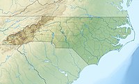
Rich Mountain[1] is roughly 7 miles (11 km) south-southwest of Boone, in Moses H. Cone Memorial Park. Its elevation reaches 4,246 feet (1,294 m).[1] Because it's within the Blue Ridge Parkway, it is protected from development. From 1922-1985, Camp Yonahlossee (Cherokee for "Trail of the Bear") was located at the western side of the mountain, it was one of the oldest all girls camp in North Carolina; today it is a resort and club.[2][3]
The mountain generates several feeder streams to the South Fork New River (via Winkler Creek[4]) and the Watauga River (via Cannon Branch[5]).
References
[edit]- ^ a b c d "Rich Mountain". Geographic Names Information System. United States Geological Survey, United States Department of the Interior. Retrieved 2019-07-30.
- ^ "Yonahlossee: History". Archived from the original on 2013-02-10. Retrieved 2011-09-11.
- ^ "Suzy's Camp Yonahlossee PowWow". Archived from the original on 2012-04-02. Retrieved 2011-09-11.
- ^ "Winkler Creek". Geographic Names Information System. United States Geological Survey, United States Department of the Interior. Retrieved 2011-09-11.
- ^ "Cannon Branch". Geographic Names Information System. United States Geological Survey, United States Department of the Interior. Retrieved 2011-09-11.
External links
[edit]- Rich Mountain on Peakbagger.

