Rasht Airport
Appearance
This article needs additional citations for verification. (May 2021) |
Rasht Airport فرودگاه رشت | |||||||||||
|---|---|---|---|---|---|---|---|---|---|---|---|
| Summary | |||||||||||
| Airport type | Public/military | ||||||||||
| Owner | Government of Iran | ||||||||||
| Operator | Iran Airports Company Islamic Republic of Iran Navy Aviation | ||||||||||
| Serves | Rasht, Gilan | ||||||||||
| Location | Rasht, Iran | ||||||||||
| Elevation AMSL | −40 ft / −12 m | ||||||||||
| Coordinates | 37°19′31.13″N 49°36′20.94″E / 37.3253139°N 49.6058167°E | ||||||||||
| Website | rasht | ||||||||||
| Map | |||||||||||
 | |||||||||||
| Runways | |||||||||||
| |||||||||||
| Statistics (2017) | |||||||||||
| |||||||||||
Source: Iran Airports Company[1] | |||||||||||
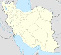
Rasht Airport (IATA: RAS, ICAO: OIGG) (Persian: فرودگاه بین المللی رشت) is an international airport located 10 kilometers north of the city of Rasht, Gilan Province, in the north of Iran. It is also known as Sardar Jangal Airport. It has flight connections to different parts of Iran, and about 446,000 passengers passed through it in 2017.
Airlines and destinations
[edit]See also
[edit]- Iran Civil Aviation Organization
- Transport in Iran
- List of airports in Iran
- List of the busiest airports in Iran
- List of airlines of Iran
References
[edit]- ^ "Traffic Figures". Retrieved 14 February 2018.

