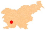
Rakulik
Appearance
Rakulik | |
|---|---|
| Coordinates: 45°44′27.51″N 14°7′47.46″E / 45.7409750°N 14.1298500°E | |
| Country | |
| Traditional region | Inner Carniola |
| Statistical region | Littoral–Inner Carniola |
| Municipality | Postojna |
| Area | |
• Total | 4.7 km2 (1.8 sq mi) |
| Elevation | 591.6 m (1,940.9 ft) |
| Population (2002) | |
• Total | 12 |
| [1] | |
Rakulik (pronounced [ɾaˈkuːlik]) is a small settlement in the hills south of Hruševje in the Municipality of Postojna in the Inner Carniola region of Slovenia.[2]
The local church, built on a small hill north of the settlement, is dedicated to Saint John of Nepomuk and belongs to the Parish of Hrenovice.[3]
References
[edit]External links
[edit]


