Rairangpur Airstrip
Appearance
Rairangpur Airstrip | |||||||||||
|---|---|---|---|---|---|---|---|---|---|---|---|
| Summary | |||||||||||
| Airport type | Public | ||||||||||
| Operator | Government of Odisha | ||||||||||
| Location | Rairangpur, Odisha, India | ||||||||||
| Elevation AMSL | 853 ft / 260 m | ||||||||||
| Coordinates | 22°18′18″N 86°08′07″E / 22.30500°N 86.13528°E | ||||||||||
| Map | |||||||||||
 | |||||||||||
| Runways | |||||||||||
| |||||||||||
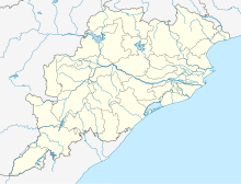
Rairangpur Airstrip, also known as Dandbose Airstrip, is located 6 km away from Rairangpur city center in Mayurbhanj district, Odisha, India.[1][2] Rairangpur Airstrip is spread over 61 acres and is under the control of the Works Department of Government of Odisha. The runway is 750 meters (around 3280 ft) long and is periodically maintained by the state government.[3][4]
Currently, there are no scheduled operations to and from this airstrip. The nearest airport is Sonari Airport in Jamshedpur, Jharkhand, 71 km from Rairangpur Airport. The state capital Bhubaneswar's Biju Patnaik International Airport is nearly 275 km from Rairangpur Airstrip.
See also
[edit]References
[edit]- ^ "List of Airstrip in the State maintained by State Government" (PDF). ct.odisha.gov.in. Commerce and Transport Department, Government of Odisha. Retrieved 14 January 2023.
- ^ "AAI Unserved Airports" (PDF). aai.aero. Airports Authority of India.
- ^ "Rairangpur Airport - Rairangpur, Odisha" (PDF). Airport Authority of India. Archived from the original (PDF) on 1 May 2018. Retrieved 30 April 2018.
- ^ "Rairangpur Airport". aai.aero.


