Raduha (mountain)
| Raduha | |
|---|---|
 | |
| Highest point | |
| Elevation | 2,062 m (6,765 ft) |
| Coordinates | 46°24′34″N 14°44′14″E / 46.40944°N 14.73722°E |
| Geography | |

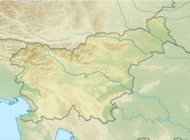
Raduha (pronounced [ˈɾaːduxa]) is a mountain in the eastern part of Kamnik–Savinja Alps in northern Slovenia.
Geography
[edit]It is separated from its main group by the Savinja Gorge. It has relatively flat top in the northeast–southwest direction. Its lower peaks are Jelovec (1,845 metres or 6,053 feet), Lanež (1,925 m or 6,316 ft), and Little Raduha (Mala Raduha, 2,029 m or 6,657 ft), and the highest peak is Big Raduha (Velika Raduha, 2,062 m or 6,765 ft). The Loka Lodge (Slovene: Koča na Loki; 1,534 m or 5,033 ft) stands east of the summit. The highest-elevation show cave in Slovenia, Snow Cave (Slovene: Snežna jama), lies on the western side. The western and northern parts are rocky. It is the site of the Grohat mountain pasture with the Grohat Lodge (Slovene: Koča na Grohatu pod Raduho, 1,460 m or 4,790 ft).
Name
[edit]Raduha was attested in written sources in 1426 as Radoch. It is based on the hypocorism Radoh, derived from a Slavic personal name such as *Radoslavъ.[1]
Starting points
[edit]Routes
[edit]- 3h: from Rogovilc, over the southeastern ridge
- 1½h: from the Loka Pasture, the southern course
- 1½h: from the Loka Pasture, via the Durce Notch
- 1½h: from the Grohat Pasture, via the Durce Notch
- 1h: from the Grohat Pasture, via the northern plains
See also
[edit]References
[edit]- ^ Snoj, Marko. 2009. Etimološki slovar slovenskih zemljepisnih imen. Ljubljana: Modrijan and Založba ZRC, p. 345.
- Slovenska planinska pot, Planinski vodnik, PZS, 2012, Milenko Arnejšek-Prle, Andraž Poljanec ISBN 978-961-6870-04-7
External links
[edit] Media related to Raduha (mountain) at Wikimedia Commons
- Routes, Description & Photos

