Qanavat
Appearance
Qanavat
Persian: قنوات | |
|---|---|
City | |
| Coordinates: 34°36′39″N 51°01′24″E / 34.61083°N 51.02333°E[1] | |
| Country | Iran |
| Province | Qom |
| County | Qom |
| District | Central |
| Population (2016)[2] | |
| • Total | 11,667 |
| Time zone | UTC+3:30 (IRST) |
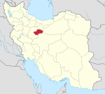
Qanavat (Persian: قنوات)[a] is a city in the Central District of Qom County, Qom province, Iran. It lies off Road 7, roughly 10 kilometres southeast of Qom.
Demographics
[edit]Population
[edit]At the time of the 2006 National Census, the city's population was 7,693 in 1,887 households.[3] The following census in 2011 counted 9,662 people in 2,634 households.[4] The 2016 census measured the population of the city as 11,667 people in 3,360 households.[2]
See also
[edit]Notes
[edit]References
[edit]- ^ OpenStreetMap contributors (13 May 2023). "Qanavat, Qom County" (Map). OpenStreetMap (in Persian). Retrieved 13 May 2023.
- ^ a b "Census of the Islamic Republic of Iran, 1395 (2016)". AMAR (in Persian). The Statistical Center of Iran. p. 25. Archived from the original (Excel) on 11 January 2021. Retrieved 19 December 2022.
- ^ "Census of the Islamic Republic of Iran, 1385 (2006)". AMAR (in Persian). The Statistical Center of Iran. p. 25. Archived from the original (Excel) on 20 September 2011. Retrieved 25 September 2022.
- ^ "Census of the Islamic Republic of Iran, 1390 (2011)". Syracuse University (in Persian). The Statistical Center of Iran. p. 25. Archived from the original (Excel) on 20 January 2023. Retrieved 19 December 2022.


