Qalorujoorneq
| Qalorngoorneq | |
|---|---|
 Aerial view of Saajat from the north | |
| Highest point | |
| Elevation | 676 m (2,218 ft)[1] |
| Geography | |
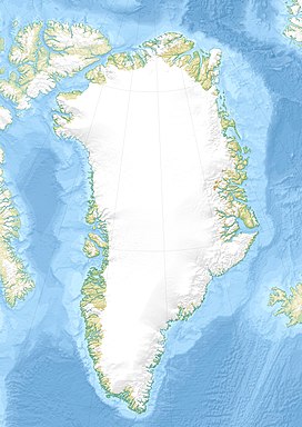
Location in Kulusuk Island | |
| Country | Greenland |
| Range coordinates | 65°33′N 37°5′W / 65.550°N 37.083°W |
Qalorngoorneq is a small mountain range in the eastern part of Kulusuk Island in Sermersooq, southeastern Greenland. At 676-metre-high (2,218 ft),[2] its highest point is the highest mountain on the island.
Geography
[edit]Qalorngoorneq is located in the eastern part of Kulusuk Island, to the southeast of the Kulusuk Airport.
Walls
[edit]To the northeast and to the east, Qalorngoorneq walls fall directly into the North Atlantic.[3] The southern wall is the smallest, and the easiest to ascend. Its western wall is the widest, with a prominent pillar in the center falling into a post-glacial cirque filled by the Qalorngoorner Imerarpia lake.
Ridges
[edit]Qalorngoorneq has three ridges. Its southeastern ridge extends to the southeastern promontory on the island, with two distinct peaks: Saajat at 603 metres (1,978 ft) and Kangeq at 280 metres (919 ft).[1]
The southwestern ridge is the easiest route to the summit, petering out with several rounded trabants in its lower reaches to the south and southwest of the lake.[3]
The northwestern ridge falls from the nearly flat summit ridge with a series of trabants, the first and highest a rocky pinnacle, the other progressively lower and rounder, extending into the interior of the island above the central reservoir lake.
See also
[edit]References
[edit]- ^ a b O'Carroll, Etain (2005). Greenland and the Arctic. Lonely Planet. p. 206. ISBN 1-74059-095-3.
- ^ Norwegian University of Science and Technology Archived 2011-06-15 at the Wayback Machine
- ^ a b Tasiilaq, Saga Map, Tage Schjøtt, 1992
External links
[edit] Media related to Qalorujoorneq at Wikimedia Commons

