Putte, Kapellen
Appearance
Putte | |
|---|---|
Village | |
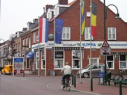
 The border between Belgium and the Netherlands in Putte. | |
| Coordinates: 51°21′02″N 4°23′52″E / 51.35056°N 4.39778°E | |
| Country | |
| Region | Flemish Region |
| Province | Antwerp |
| Municipality | Kapellen |
| Area | |
• Total | 5.81 km2 (2.24 sq mi) |
| Population (2021)[1] | |
• Total | 3,833 |
| • Density | 660/km2 (1,700/sq mi) |
| Time zone | CET |
Putte is a village on the border between Belgium and the Netherlands.
The village is marked by the borders that run through it. The Dutch part is in Woensdrecht, North Brabant. The Belgian part is mostly the municipality of Kapellen and a small part in the municipality of Stabroek, both are in the province of Antwerp.[2]
The Nationale Sluitingsprijs, the last road bicycle racing of the season, is held in Putte.[3]
History
[edit]The village became the property of the Duke of Hoogstraten in 1714. In 1828, the village was divided into a Dutch and Belgian part. The main part of the village is on the Belgian side.[2] The population of the village in 2007 was 3,464 people.[3]
Gallery
[edit]-
Chapel in Putte
-
Nationale Sluitingsprijs 2016
-
Nature area Putse Moer
See also
[edit]References
[edit]- ^ a b "Bevolking per statistische sector - Sector 11023A1". Statistics Belgium. Retrieved 9 May 2022.
- ^ a b "Kapellen". Agentschap Onroerend Erfgoed (in Dutch). Retrieved 30 October 2020.
- ^ a b "Putte in Beeld". Breda en alles daaromheen (in Dutch). Retrieved 30 October 2020.
External links
[edit] Media related to Putte (village), Belgium at Wikimedia Commons


