Punggye-ri
Appearance
Punggye-ri
풍계리 | |
|---|---|
| Korean transcription(s) | |
| • Chosŏn'gŭl | 풍계리 |
| • Hancha | 豊溪里 |
| • McCune-Reischauer | P'unggyeri |
| • Revised Romanization | Punggyeri |
 | |
| Coordinates: 41°16′42″N 129°05′13″E / 41.278347°N 129.087027°E | |
| Country | North Korea |
| Province | North Hamgyong Province |
| County | Kilju County |
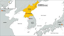
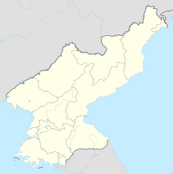
P'unggye-ri is a village located in Kilju County, North Hamgyong Province, North Korea. The Punggye Station serves the village. The Punggye-ri Nuclear Test Site is located nearby.[1]
See also
[edit]- Punggye-ri Nuclear Test Site - The primary nuclear test site in DPRK
References
[edit]- ^ "Punggye-ri: What we know about North Korea's nuclear test site". BBC News. 2017-09-04. Retrieved 2024-09-02.

