Puʻu Hawaiʻiloa
Appearance
| Puʻu Hawaiʻiloa | |
|---|---|
 A photo of Pu'u Hawai'iloa by Marine Corps Base Hawaii | |
| Highest point | |
| Elevation | 337 ft (103 m) |
| Coordinates | 21°26′53″N 157°45′24″W / 21.44806°N 157.75667°W |
| Geography | |
| Location | Honolulu County, Hawaii, United States |
| Geology | |
| Mountain type | Cinder cone |
| Last eruption | 450,000 - 420,000[citation needed] |
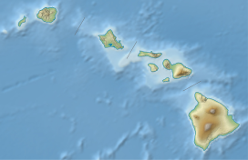
Puʻu Hawaiʻiloa is a cinder cone located in Honolulu County, Hawaii on the Mokapu Peninsula.[1][2]
Much like neighboring Ulupaʻu Crater. it formed as a vent of the Koʻolau Range during the Honolulu Volcanic Series. The material of the cone is nepheline basalt.[2] Puʻu Hawaiʻiloa is used by Marine Corps Base Hawaii and the Wailuku Community Center is next to it.[3]
See also
[edit]References
[edit]- ^ "Puu Hawaiiloa". Mapcarta. Retrieved 2020-08-06.
- ^ a b "Geolex — Hawaiiloa publications". ngmdb.usgs.gov. Retrieved 2020-08-06.
- ^ "Military Homes | Ohana Military Communities - Marines | Waikulu". www.ohanamarinecorpscommunities.com. Retrieved 2020-08-06.

