Prestreljenik
| Prestreljenik | |
|---|---|
| Monte Forato | |
 | |
| Highest point | |
| Elevation | 2,499 m (8,199 ft) |
| Listing | Mountains in Slovenia |
| Coordinates | 46°21′42″N 13°28′19″E / 46.36174°N 13.47207°E |
| Geography | |
| Countries | Slovenia and Italy |
| Parent range | Julian Alps |
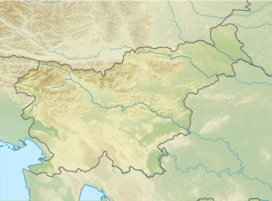
Prestreljenik (Italian: Monte Forato) is a 2,499-meter (8,199 ft) mountain in the western range of the Julian Alps. The summit of the mountain lies on the Italian–Slovenian border, which runs along the Kanin group ridge in the area. The mountain's southern and northern slopes lie in the Slovenian municipality of Tolmin and the Italian commune of Udine, respectively.
The second-highest peak of the central part of the Kanin group, Prestreljenik is located about 2.5 km west of High Kanin / Canin Alto. It is best known for the "Window" (Okno), an erosion-arch feature located on its western ridge. This aperture is the source of both of the mountain's local endonyms, Prestreljenik ("shot-through" in Slovene) and Forato (Italian for "pierced").
The peak is accessible via the eastern ridge from the Petar Skalar Lodge, or—by a different route—via either Bovec or (crossing the Italian border) Sella Nevea and the Celso Gilberti Chalet. In winter, the peak is a popular destination for alpine skiers.[1][2]

See also
[edit]References
[edit]- ^ "Na Kanin to poletje z žičnico že več kot 11.000 obiskovalcev". Primorske Novice. Retrieved 2017-08-16.
- ^ "Družinsko plezanje nad kaninskimi prepadi". www.delo.si. Retrieved 2017-08-16.
External links
[edit]


