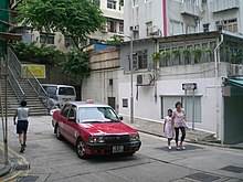
Pound Lane


Pound Lane (Chinese: 磅巷) is a lane in Sheung Wan on Hong Kong Island, Hong Kong.
Location
[edit]Pound Lane is located between Bonham Road and Hollywood Road. The Lane runs parallel to Po Yan Street and Upper Station Street.
Name
[edit]It was the site of a government pound where straying animals, like cows and sheep, were kept.[citation needed] The Lane appeared on the Rates List for 1870.[citation needed] There was one Yee Yik occupied premises in the lane and he was a cowkeeper, while another building was occupied by one Chaoupai who was listed as a goatherd.[citation needed]
The Chinese name mistakenly refers to the unit of measurement.[1]
Nearby
[edit]- Tung Wah Hospital
- Tai Ping Shan Street
- Blake Garden
- Po Hing Fong
- Catholic Mission School
- Rutter Street
- Government Quarters, Sheung Wan
- Hospital Road
- Hop Yat Church
Second mid-level escalator
[edit]The Central and Western District Council is considering installing a new escalator on Pound Lane, the Blake Garden area could well be on its way to becoming Hong Kong's next trendy neighbourhood. Urban planning critic John Batten, who has lived in the neighbourhood for nearly 20 years, is blunt about the prospects. "The escalator would be the death of the area," he said. Noise levels would increase, prices would go up and developers would be keen to exploit the area's 30-storey height limits. "You have to wonder who is pushing this idea behind the scenes," he said. The escalator's chief proponent has been the local branch of the Democratic Alliance for the Betterment of Hong Kong, whose community relations officer, Kathy Siu Ka-yi, can be seen on dozens of posters and banners supporting the project.[2]
See also
[edit]References
[edit]- Bloomfield, Frena (1984). Hong Kong's Street Names and Their Origins. Vol. 1. Urban Council, Hong Kong. ASIN B000HZIVAE. OCLC 320407030. Archived from the original on 2014-11-07.
- ^ Pang, Diana. "Foreign influence Part 1: Lost in translation, Hong Kong's weird and wonderful street names | Hong Kong Free Press HKFP". hongkongfp.com.
- ^ A sleepy area caught between slow gentrification or mass development Archived 2011-09-15 at the Wayback Machine South China Morning Post. Christopher DeWolf. 27 March 2011.
External links
[edit]- "Stairs of Pound Lane / Tai Ping Shan Street to Bonham Road". Hong Kong Stair Archive. Stair Culture. 7 March 2016.
22°17′05″N 114°08′51″E / 22.2846°N 114.1474°E
