Portal:Volcanoes/Selected article/9
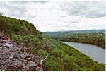
The Metacomet Ridge of southern New England is a narrow and steep fault-block mountain ridge known for its extensive cliff faces, scenic vistas, microclimate ecosystems, and communities of plants considered rare or endangered. An important recreation resource located within 10 miles (16 km) of a population corridor of over 2.5 million people, the ridge is home to four long distance hiking trails and over a dozen parks and recreation areas including several state and nationally recognized historic sites. Because of its natural, historic, and recreational value, the ridge has been the focus of ongoing conservation efforts involving municipal, state, and national agencies as well as nearly two dozen non-profit organizations. The Metacomet Ridge extends from New Haven and Branford, Connecticut on Long Island Sound, through the Connecticut River Valley region of Massachusetts, to northern Franklin County, 2 miles (3.2 km), short of the Vermont and New Hampshire borders, a distance of 100 miles (160 km). Younger and geologically distinct from the nearby Appalachian Mountains and surrounding uplands, the Metacomet Ridge is composed of volcanic basalt, also known as traprock, and sedimentary rock in faulted and tilted layers many hundreds of feet thick. In most, but not all cases, the basalt layers are dominant, prevalent, and exposed.

