Portal:Oregon/Selected article/9
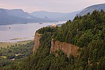
The Columbia River is a river that flows from the Canadian province of British Columbia, through the U.S. state of Washington, and forms much of the border between Washington and Oregon before emptying into the Pacific Ocean. It is the largest river (measured by volume) flowing into the Pacific from the Western Hemisphere, and is the fourth-largest in North America. It is 1,243 miles (2,000 km) long and drains a 258,000 square miles (670,000 km2) basin. Humans have lived along the river for as many as 10,000 years. Natives enjoyed plentiful salmon, which could be easily caught during their spawning season; Celilo Falls, just east of the Columbia River Gorge, was an important fishing site, and also a regional trading hub, for many millennia. In 1775, Bruno de Heceta became the first European to sight the river's mouth from the Pacific. Spanish, American, and British explorers sought the river, seeking furs to trade and a navigable passage to the east coast of the continent. The river proved elusive until 1792, when American Robert Gray entered the river's mouth and named the river after his ship; and the English captain George Vancouver's crew explored it as far upstream as the Sandy River. Navigation by steamboats, and later by railroads along the river, was crucial to the settlement and trade in the 19th century. The Columbia's heavy flow, and its large elevation drop over a relatively short distance, give it tremendous potential for hydroelectricity generation. 14 dams on the Columbia, and many more on its tributaries, were built in the 20th century. The dams, and other industry near the river, profoundly altered the ecology and economy of the region; today Celilo Falls and other fishing sites have been flooded by lakes, which make up nearly the entire length of the once free-flowing river. The once plentiful salmon now struggle to reach their spawning grounds, and the removal of some of the dams to mitigate their impact on the fish is increasingly under consideration.

