Portal:Islands/Selected article/27

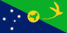
The Territory of Christmas Island is an Australian external territory in the Indian Ocean comprising the island of the same name. It is located approximately 350 kilometres (190 nautical miles) south of Java and Sumatra and about 1,550 km (840 nmi) north-west of the closest point on the Australian mainland. It has an area of 135 square kilometres (52 sq mi). The territory derives its name from its discovery on Christmas Day 1643 by Captain William Mynors.
Christmas Island had a population of 1,692 residents as of 2021[update], with the majority living in settlements on the northern edge of the island. The main settlement is Flying Fish Cove. Historically, Asian Australians of Chinese, Malay, and Indian descent formed the majority of the population. Today, around two-thirds of the island's population is estimated to have Straits Chinese origin (though just 22.2% of the population declared a Chinese ancestry in 2021), with significant numbers of Malays and European Australians and smaller numbers of Straits Indians and Eurasians. Several languages are in use including English, Malay, and various Chinese dialects. Religious beliefs vary geographically; the Anglo-Celtic influence in the capital known simply as The Settlement means it is closely tied to Catholicism, whereas in the Poon Saan area Buddhism is common, and Sunni Islam is generally observed in the shoreline water village where the Malays live. The religion question in the Australian census is optional, and 28% of the population do not declare their religious belief. (Full article...)
