Portal:India/Today's selected article/March 31, 2006
| This page is currently inactive and is retained for historical reference. Either the page is no longer relevant or consensus on its purpose has become unclear. To revive discussion, seek broader input via a forum such as the village pump. |
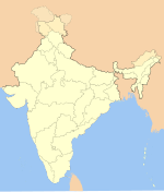
The political integration of India established a united nation for the first time in thousands of years from a plethora of princely states, colonial provinces and possessions. Despite partition, a new India arose above demographic distinctions to unite peoples of various geographic, economic, ethnic, linguistic and religious backgrounds. India was transformed after independence through political upheaval and ethnic discontent, and continues to evolve as a federal republic natural to its diversity. The process is defined by sensitive religious conflicts between Hindus and Muslims, diverse ethnic populations, as well as by geo-political rivalry and military conflicts with Pakistan and China. When the Indian independence movement succeeded in ending British Raj on August 15, 1947, India's leaders faced the prospect of inheriting a nation fragmented between medieval-era kingdoms and provinces organized by colonial powers. Under the leadership of Sardar Vallabhbhai Patel, one of India's most respected freedom fighters and the Minister of Home Affairs, the new Government of India employed frank political negotiations backed with the option of military action to weld a nation.(more...)
Recently appeared: Greco-Buddhism – Sikkim – Kalimpong

