Portal:Cumbria/Selected lake
Appearance
| This Wikipedia page has been superseded by Portal:Cumbria and is retained primarily for historical reference. |
| Note: Article entries are now being transcluded directly on the main portal page. However, this page should be retained for historical reference. |
Selected lake
Any article of a moderate standard (longer than a stub, referenced and lacking any serious cleanup templates) about a lake, mere, tarn or other similar feature in Cumbria may be added below. Use the format-
{{Portal:Cumbria/Selected article/Layout
|image=
|caption=
|text=
|link=
}}
Portal:Cumbria/Selected lake/1
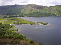
Derwentwater occupies part of Borrowdale and lies immediately south of the town of Keswick. It is both fed and drained by the River Derwent. It measures approximately 3 miles (4.8 km) long by 1 mile (1.6 km) wide and is some 72 feet (22 m) deep. There are several islands within the lake, one of which is inhabited. Derwent Island House, an 18th century residence, is a tenanted National Trust property open to the public on five days each year. (more...)
Portal:Cumbria/Selected lake/2
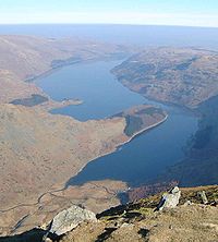
Haweswater is a reservoir built in the valley of Mardale. The controversial construction of the Haweswater dam started in 1929, after Parliament passed an Act giving the Manchester Corporation permission to build the reservoir to supply water for the urban conurbations of north-west England. At the time, there was public outcry about the decision, as the valley of Mardale was populated by the farming villages of Measand and Mardale Green and the construction of the reservoir would mean that these villages would be flooded and lost and the population would have to be moved. In addition, the valley was considered one of the most picturesque in Westmorland and many people thought it should be left alone. (more...)
Portal:Cumbria/Selected lake/3
Rydal Water is a small lake in the central region of the Lake District. It is located near the hamlet of Rydal, between Grasmere and Ambleside in the Rothay Valley. The lake is 1290yd (1.18km) long and varies in width up to a maximum of 380yd (350m), covering an area of 0.12mi² (0.31km²). It has a maximum depth of 65ft (17m) and an elevation above sea level of 177ft (54m). The lake is both drained and replenished by the river Brathay, flowing out of Grasmere upstream and into Windermere downstream. The waters of the southern half of the lake are leased by the Lowther Estate to the National Trust, whilst those of the northern half belong to the estate of Rydal Hall. Navigation is prohibited, except for residents of Rydal Hall. (more...)
Portal:Cumbria/Selected lake/4
Ullswater is the second largest lake in the Lake District, being approximately nine miles (14.5 kilometres) long and 0.75 miles (1,200 m) wide with a maximum depth of slightly more than 60 metres (197 ft). It is a typical Lake District narrow "ribbon lake" formed after the last ice age when a glacier scooped out the valley floor and when the glacier retreated, the deepened section filled with meltwater which became a lake. The surrounding mountains give Ullswater the shape of an elongated 'Z' with three distinct segments (or 'reaches') that wend their way through the surrounding hills. For much of its length Ullswater forms the border between the ancient counties of Cumberland and Westmorland. (more...)
Portal:Cumbria/Selected lake/5
Wast Water or Wastwater is a lake in the . The lake is approximately 4.6 kilometres (almost 3 miles) long and 600 metres (more than a third of a mile) wide, and is located in the Wasdale Valley. It is the deepest lake in England at 79 metres (258 ft), and is owned by the National Trust. The head of the Wasdale Valley is surrounded by some of the highest mountains in England, including Scafell Pike, Great Gable and Lingmell. Wast Water is the source of the River Irt which flows into the Irish Sea near Ravenglass. (more...)
Portal:Cumbria/Selected lake/6
Windermere is the largest natural lake in England. It has been one of the country’s most popular places for holidays and summer homes since 1847, when the Kendal and Windermere Railway built a branch line to it. The lake is drained from its southernmost point by the River Leven. It is replenished by the rivers Brathay, Rothay, Trout Beck, Cunsey Beck and several other lesser streams. The lake is largely surrounded by foothills of the Lake District which provide pleasant low-level walks; to the north and north-east are the higher fells of central Lakeland. There are two towns on the lake, Ambleside and Bowness-on-Windermere, as the town of Windermere does not directly touch the lake. (more...)


