Jump to content

Portal:California roads/Selected picture

From Wikipedia, the free encyclopedia

Usage

[edit]

The layout design for these subpages is at Portal:California Roads/Selected picture/Layout.

  1. Add a new Selected picture to the next available subpage.
  2. Update "max=" to new total for its {{Random portal component}} on the main page.

Selected pictures list

[edit]

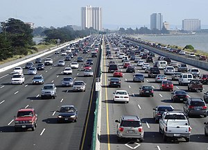
Portal:California Roads/Selected picture/1

I-80 on the Eastshore Freeway
Credit: Minesweeper
Interstate 80 is a major urban freeway though the East Bay, north of the Bay Bridge, in the San Francisco Bay Area (seen here in Berkeley, California).

Portal:California Roads/Selected picture/2

Interstate 15 in the Ivanpah Valley
Credit: Stan Shebs
Northbound, Interstate 15 makes a steep descent from Mountain Pass into the Ivanpah Valley. In the middle distance, the casinos of Primm straddle the freeway right at the Nevada border, while those of Jean are further off, to the left; Las Vegas is immediately on the far side of the hills on the horizon.

Portal:California Roads/Selected picture/3

Pasadena Freeway
Pasadena Freeway
Credit: Steve Devorkin

Portal:California Roads/Selected picture/4

A river flowing between two wooded mountains with a railroad trestle crossing it and a higher road bridge past the trestle
Credit: Davemeistermoab
The Pulga bridge along California State Route 70 which crosses the Feather River Route and the Feather River

Portal:California Roads/Selected picture/5

Foresthill Bridge
Foresthill Bridge
Credit: Neil916
The four-lane Foresthill Bridge was built in 1971 to replace the low crossing of the American River on State Route 49 in preparation for the construction of the Auburn Dam. The dam was canceled for environmental reasons, but the bridge, the tallest in California, remains along the local Foresthill Road.

Portal:California Roads/Selected picture/6

Credit: NE2
A 1948 plan showing San Francisco's trafficways, which would later become the freeways and major streets in the city

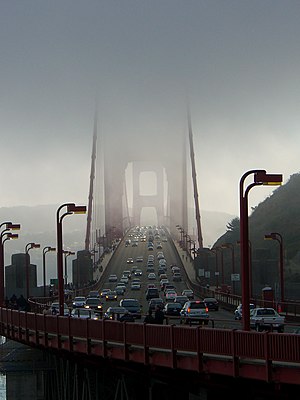
Portal:California Roads/Selected picture/7

A view of the Golden Gate Bridge along U.S. Route 101 in California during a foggy day

Portal:California Roads/Selected picture/8

Credit: Ian McWilliams
The Bixby Creek Bridge along California State Route 1 in Big Sur, with the Pacific Ocean in the background

Portal:California Roads/Selected picture/9

Credit: Dietmar Rabich

Portal:California Roads/Selected picture/10

Credit: Rschen7754

Portal:California Roads/Selected picture/11

Credit: Rschen7754

Portal:California Roads/Selected picture/12

Credit: Luke Jones

Portal:California Roads/Selected picture/13


Portal:California Roads/Selected picture/14

Credit: Michael Grindstaff

Portal:California Roads/Selected picture/15

U.S. Route 395 over Deadman's Summit in the Sierra Nevada near Mammoth Lakes

Portal:California Roads/Selected picture/16


Portal:California Roads/Selected picture/17

Credit: Steve Lyon

Portal:California Roads/Selected picture/18

Credit: A Silly Person
Sunset over Sonora Pass, California on California State Route 108

Nominations

[edit]

Feel free to add related featured pictures to the above list. Other pictures may be nominated here.