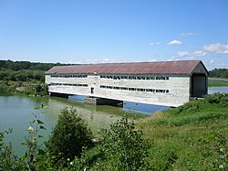
Pont de l'Île
Appearance
Pont de l'Île | |
|---|---|
 | |
| Coordinates | 48°41′30″N 79°24′27″W / 48.691667°N 79.4075°W |
| Carries | Road Bridge |
| Crosses | Lake Abitibi |
| Locale | Clerval, Quebec, Canada |
| Characteristics | |
| Design | Town lattice |
| Material | Wood |
| Total length | 52m |
| Clearance above | 4.10m |
| History | |
| Opened | 1946 |
| Location | |
 | |
The pont de l'Île is a covered bridge near the municipality of Clerval, Quebec, Canada. It connects an island, L'Île-Nepawa, in Lake Abitibi to the mainland.[1]
The single-lane bridge is of Lattice truss bridge design.[2] This design was modified by the Quebec Ministry of Colonisation and was used for more than 500 covered bridges in Quebec. Thirty-four covered bridges were built in Abitibi, during the colonisation of the region.[3] Today fewer than half of them are extant.
Built in 1946, a metal pillar was added in 1997. In 2012 the bridge was restored, including a new roof, new woodwork, and it was painted red, having been beige.
The weight capacity is 12 tonnes. It does not benefit from any provincial or municipal protection.
See also
[edit]References
[edit]- ^ "À la découverte de l'arrière-pays et de ses ponts couverts". Tourisme Abitibi-Témiscamingue (in French). Retrieved 29 October 2020.
- ^ "Ile". Les ponts couverts au Québec (in French). Retrieved 29 October 2020.
- ^ Arbour, Gérald. "Ponts couverts au Québec". L'Encyclopédie du patrimoine culturel de l'Amérique française (in French). Retrieved 21 October 2020.
