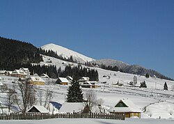
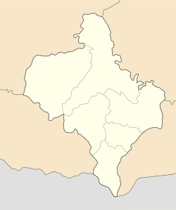
Polianytsia, Nadvirna Raion, Ivano-Frankivsk Oblast
Polianytsia
Поляниця | |
|---|---|
 | |
| Coordinates: 48°21′03″N 24°26′38″E / 48.35083°N 24.44389°E | |
| Country | |
| Oblast | Ivano-Frankivsk Oblast |
| Raion | Nadvirna Raion |
| Hromada | Polianytsia rural hromada |
| Established | 1943 |
| Elevation | 910 m (2,990 ft) |
| Population (2023) | 615 |
Polianytsia[a] (Ukrainian: Поляниця; Polish: Polanica) is a village in Nadvirna Raion, Ivano-Frankivsk Oblast, Ukraine. It is the administrative centre of the Polianytsia rural hromada.[1] Its population is 615 As of 2023[update].[2]
History
[edit]The village of Polianytsia was first mentioned in 1820. During the early 20th century, the village was developed at the behest of Johann II, Prince of Liechtenstein, who owned several properties within the village. A church was built under his supervision in 1912. During World War II, the church, along with the village's school, was destroyed by German forces, and 40 of the town's 300 pre-war residents remained in the village by the war's end. The village is inhabited by ethnic Hutsuls.[3]
The village is home to the Bukovel ski resort.[4]
Notes
[edit]References
[edit]- ^ "Поляницька територіальна громада" [Polianytsia territorial hromada]. decentralization.gov.ua (in Ukrainian). Retrieved 25 July 2023.
- ^ "Поляницька громада" [Polianytsia hromada]. gromada.info (in Ukrainian). Retrieved 25 July 2023.
- ^ "Історія села Поляниця" [History of the village of Polianytsia]. Polianytsia rural hromada (in Ukrainian). Retrieved 25 July 2023.
- ^ "Пoляниця" [Polianytsia]. karpaty.info (in Ukrainian). Retrieved 25 July 2023.


