Pittsburgh Northeast Airport
Pittsburgh Northeast Airport (West Penn Airport) (Rock Airport) | |||||||||||
|---|---|---|---|---|---|---|---|---|---|---|---|
 | |||||||||||
| Summary | |||||||||||
| Airport type | Public use | ||||||||||
| Owner | Alaskan Property Management Co LLC | ||||||||||
| Serves | Pittsburgh / Tarentum, Pennsylvania | ||||||||||
| Location | Indiana Township, West Deer Township, Pennsylvania | ||||||||||
| Elevation AMSL | 1,063 ft / 324 m | ||||||||||
| Coordinates | 40°36′13″N 079°49′34″W / 40.60361°N 79.82611°W | ||||||||||
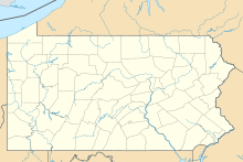
| Map | |||||||||||
 | |||||||||||
| Runways | |||||||||||
| |||||||||||
| Statistics (2024) | |||||||||||
| |||||||||||
Pittsburgh Northeast Airport (FAA LID: 9G1) is a privately owned, public use airport in Allegheny County, Pennsylvania, United States.[1] The airport is located 12 nautical miles (14 mi, 22 km) north-northeast of the central business district of Pittsburgh,[1] in West Deer Township. The airport is located a few miles north of Pittsburgh Mills shopping mall.
Facilities and aircraft
[edit]Pittsburgh Northeast Airport covers an area of 149 acres (60 ha) at an elevation of 1,063 feet (324 m) above mean sea level. It has one runway designated 17/35 with an asphalt surface measuring 3,550 by 100 feet (1,082 x 30 m).[1]
For the 12-month period ending November 23, 2011, the airport had 2,982 aircraft operations, an average of 248 per month: 99% general aviation and 1% military. At that time there were 20 aircraft based at this airport: 95% single-engine and 5% multi-engine.[1] As of March 2019, no aircraft are based in the facility.[2]
History
[edit]The property went through a major overhaul between 2000 and 2004, and can now accommodate larger aircraft.[citation needed] The airport's former runway, designated 2/20, had an asphalt surface measuring 2,645 by 36 feet (806 x 11 m).[3]
This airport was included in the National Plan of Integrated Airport Systems for 2009–2013, which categorized it as a general aviation facility.[4] It was originally known as West Penn Airport.[citation needed]
Formerly known as Rock Airport, Pittsburgh Northeast Airport was bought for $9 million in 2014 by Alaskan Property Management, a subsidiary of Management Science Associates, after the former owner filed for bankruptcy.[2]
In 2022, the airport was owned by Carnegie Mellon University and used to test drones.[5]
Incidents
[edit]On May 11, 2011, shortly after 1:45pm two students, a science teacher, and a pilot attempted a takeoff on runway 35. They went off of the end of the runway and fell off of the bank.[6]
See also
[edit]References
[edit]- ^ a b c d e FAA Airport Form 5010 for 9G1 PDF. Federal Aviation Administration. Effective April 18, 2024.
- ^ a b "West Deer officials left to wonder about status of airport property". 13 March 2019.
- ^ "9G1 – Rock Airport". FAA data republished by AirNav. February 16, 2006. Archived from the original on February 26, 2006.
- ^ "2009–2013 NPIAS Report, Appendix A: Part 4" (PDF). National Plan of Integrated Airport Systems. Federal Aviation Administration. October 15, 2008. Archived from the original (PDF, 1.61 MB) on June 6, 2011.
- ^ Irvin-Mitchell, Atiya (12 September 2022). "KEF Robotics is flying high with DoD research grants and Pittsburgh support". Technical.ly. Retrieved 20 April 2024.
- ^ "Home".
External links
[edit]- Rock Airport website
- Rock Airport at Pennsylvania DOT Bureau of Aviation
- Aerial image as of April 1993 from USGS The National Map
- FAA Terminal Procedures for 9G1, effective November 28, 2024
- Resources for this airport:
- FAA airport information for 9G1
- AirNav airport information for 9G1
- ASN accident history for 9G1
- FlightAware airport information and live flight tracker
- SkyVector aeronautical chart for 9G1


