Pine Brook Hill, Colorado
Pine Brook Hills, Colorado | |
|---|---|
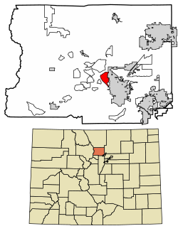
 Location of the Pine Brook Hill CDP in Boulder County, Colorado. | |
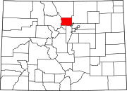
Location of the Pine Brook Hill CDP in the United States | |
| Coordinates: 40°02′46″N 105°18′35″W / 40.04611°N 105.30972°W[1] | |
| Country | |
| State | |
| County | Boulder County |
| Government | |
| • Type | unincorporated community |
| Area | |
• Total | 7.426 km2 (2.867 sq mi) |
| • Land | 7.408 km2 (2.860 sq mi) |
| • Water | 0.018 km2 (0.007 sq mi) |
| Elevation | 1,993 m (6,539 ft) |
| Population | |
• Total | 975 |
| • Density | 130/km2 (340/sq mi) |
| Time zone | UTC-7 (MST) |
| • Summer (DST) | UTC-6 (MDT) |
| ZIP Code[4] | Boulder 80304 |
| Area codes | 303 & 720 |
Pine Brook Hill is an unincorporated community and a census-designated place (CDP) located in and governed by Boulder County, Colorado, United States. The CDP is a part of the Boulder, CO Metropolitan Statistical Area. The population of the Pine Brook Hill CDP was 975 at the United States Census 2020.[3] The Boulder post office (Zip Code 80304) serves the area.[4]
Geography
[edit]Pine Brook Hill is located in central Boulder County on the northwest edge of the city of Boulder. It is located in the hills directly overlooking Boulder, with elevations ranging from 5,800 feet (1,800 m) at the eastern base of the hills to 6,953 feet (2,119 m) on a hilltop near the western edge of the CDP.
The Pine Brook Hill CDP has an area of 1,835 acres (7.426 km2), including 4.4 acres (0.018 km2) of water.[2]
Demographics
[edit]The United States Census Bureau initially defined the Pine Brook Hill CDP for the United States Census 2010.
| Year | Pop. | ±% |
|---|---|---|
| 2010 | 983 | — |
| 2020 | 975 | −0.8% |
| Source: United States Census Bureau | ||
See also
[edit]References
[edit]- ^ a b c d U.S. Geological Survey Geographic Names Information System: Pine Brook Hill, Colorado
- ^ a b "State of Colorado Census Designated Places - BAS20 - Data as of January 1, 2020". United States Census Bureau. Retrieved December 12, 2020.
- ^ a b United States Census Bureau. "Pine Brook Hill CDP, Colorado". Retrieved April 18, 2023.
- ^ a b "Zip Code 80304 Map and Profile". zipdatamaps.com. 2020. Retrieved December 20, 2020.


