Pinciná
Appearance


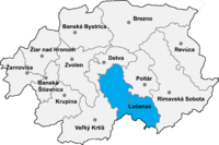
Pinciná (Hungarian: Pinc) is a village and municipality in Lučenec District in the Banská Bystrica Region of southern central Slovakia.
History
[edit]In historical records the village was first mentioned in 1326.
Geography
[edit]The municipality lies at an altitude of 190 metres and covers an area of 11.917 km2. It has a population of about 245 people.
External links
[edit]Wikimedia Commons has media related to Pinciná.
48°22′N 19°46′E / 48.367°N 19.767°E
