Piding
Piding | |
|---|---|
 Church of the Birth of the Virgin Mary | |
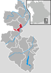
Location of Piding within Berchtesgadener Land district  | |
| Coordinates: 47°46′N 12°55′E / 47.767°N 12.917°E | |
| Country | Germany |
| State | Bavaria |
| Admin. region | Oberbayern |
| District | Berchtesgadener Land |
| Government | |
| • Mayor (2020–26) | Hannes Holzner[1] (CSU) |
| Area | |
• Total | 17.55 km2 (6.78 sq mi) |
| Elevation | 455 m (1,493 ft) |
| Population (2023-12-31)[2] | |
• Total | 5,464 |
| • Density | 310/km2 (810/sq mi) |
| Time zone | UTC+01:00 (CET) |
| • Summer (DST) | UTC+02:00 (CEST) |
| Postal codes | 83448–83451 |
| Dialling codes | 08651 |
| Vehicle registration | BGL |
| Website | www.piding.de |
Piding is an approved climatic spa in Bavaria near to the border of Austria close to Bad Reichenhall and Freilassing.
Geography
[edit]Geographical position
[edit]Piding is located in the middle of the Landkreis Berchtesgadener Land.
The municipal area corresponds to a natural expanse: It is bounded by the mountains Hochstaufen (1771 m) and Fuderheuberg (1.350 m) in the South, by the river Saalach in the East and by the hill Högl in the North-West. In the North-East the Saalach shapes the borderline to Salzburg (Austria).
Districts and Neighbours
[edit]The districts are Piding, Kleinhögl, Bichlbruck, Urwies, Mauthausen, Staufenbrücke and Pidingerau.
Immediate neighbours are the town Bad Reichenhall and the municipalities Ainring and Anger.
History
[edit]Archaeological troves shows, that the region was already populated in the New Stone Age (about 2800 BC). During the construction of the (former) ski-lift at the Fuderheuberg in 1970 copper bars from the Bronze Age were found.
Religions
[edit]The Catholic parish Maria Geburt (birth of Mary) is responsible for this churches:
- parish church Maria Geburt (Piding)
- St. Laurentius (Mauthausen)
- St. Johannes at Johannishögl (no regular masses)
Development of population
[edit]1790: 635 inhabitants; 1910: 864; 1946: 1,540; 1985: 3,996; 2000: 5,093; 2002: 5,257.
Coat of arms
[edit]The municipal coat of arms from 1962 refers to the former relations to arch-monastery and chapter Salzburg (black lion's head) and to the Höglwörth Abbey (cross-over silver keys).
Politics
[edit]Municipal council
[edit]Elections in 2014
- CSU: 9 seats
- Free voters: 6 seats
- Alliance 90/The Greens: 3 seats
- SPD: 2 seats
Mayor
[edit]First (governing) mayor is Hannes Holzner (CSU), second mayor Walter Pfannerstill (FWG) and third mayor Dr. Bernhard Zimmer (Grüne).
Culture and sights
[edit]Music/Tradition
[edit]- Club for the preservation of traditional costumes, "D'Staufenecker"
- Traditional band
Buildings
[edit]- Schloss Staufeneck
Sport
[edit]- tennis hall, tennis courts
- 50 km (31 mi) hiking trails, 12 km (7.5 mi) cross-country ski runs (tracked)
- Pidinger Klettersteig (fixed rope route) to the Hochstaufen
- Football ground
Economy and infrastructure
[edit]Traffic
[edit]Next to Piding is the last exit of the motorway A 8 (Munich-Salzburg) in front of the border to Austria. The federal road B 20 (Berchtesgaden-Oberpfalz) is tangent to Piding. Piding has its own railway station on the Freilassing-Berchtesgaden railway line.
Education
[edit]- Primary and secondary school
- Rupertusschule (school for handicapped persons)
Characters
[edit]Honorary citizens
[edit]- Max Wieser: former mayor
Literature
[edit]- Max Wieser: Pidinger Heimatbuch, 1250 Jahre Piding - Verlag Plenk, Berchtesgaden 1985
References
[edit]- ^ Liste der ersten Bürgermeister/Oberbürgermeister in kreisangehörigen Gemeinden, Bayerisches Landesamt für Statistik, accessed 19 July 2021.
- ^ Genesis Online-Datenbank des Bayerischen Landesamtes für Statistik Tabelle 12411-003r Fortschreibung des Bevölkerungsstandes: Gemeinden, Stichtag (Einwohnerzahlen auf Grundlage des Zensus 2011).


