Phurbi Chyachu
Appearance
| Phurbi Chyachu | |
|---|---|
 Phurbi Chhyachu (Jugal Himal) view from Panch Pokhari, Nepal, 14 October 2019 | |
| Highest point | |
| Elevation | 6637 |
| Coordinates | 28°07′50″N 85°52′19″E / 28.13056°N 85.87194°E |
| Naming | |
| Native name |
|
| Geography | |
| Country | Nepal |
| Parent range | Himalayas |
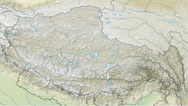
Phurbi Chyachu (also known as Phurbi Chhyachu and Purbi Gyachu) is a mountain peak in the Himalayas on the border of Nepal and the Tibet Autonomous Region.
Location
[edit]The peak is located at 6,637 m (21,775 ft),[1] north west of Sino-Nepal border crossing at Kodari, near Tatopani.
Climbing history
[edit]The first ascent was made on May 1, 1982, by a Japanese expedition consisting of Shintaro Kurokawa, Fumihito Ogawa, Hiromitsu Okamoto, Takashi Shingaki, Hajime Takigami, Ang Phuri Lama, and Pemba Lama Sherpa.[2]
References
[edit]- ^ "Phurbi Chyachu". nepalhimalpeakprofile.org. Retrieved 2022-04-22.
- ^ "05 Phurbi Chyachu From Near Taro Tso". www.mountainsoftravelphotos.com. Retrieved 2022-04-22.


