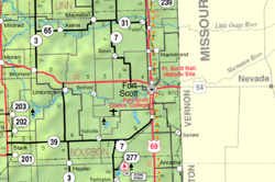
Pawnee Station, Kansas
Appearance
Pawnee Station, Kansas | |
|---|---|
 | |
| Coordinates: 37°42′00″N 94°47′29″W / 37.70000°N 94.79139°W[1] | |
| Country | United States |
| State | Kansas |
| County | Bourbon |
| Founded | 1871 |
| Elevation | 994 ft (303 m) |
| Time zone | UTC-6 (CST) |
| • Summer (DST) | UTC-5 (CDT) |
| Area code | 620 |
| FIPS code | 20-54910 |
| GNIS ID | 475000[1] |
Pawnee Station is an unincorporated community in Bourbon County, Kansas, United States.[1]
History
[edit]Pawnee Station was founded in 1871 when the railroad was extended to that point. The community took its name from Pawnee Creek.[2] A post office was established at Pawnee Station in 1871, and remained in operation until 1945.[3]
References
[edit]- ^ a b c d U.S. Geological Survey Geographic Names Information System: Pawnee Station, Kansas
- ^ "Many Towns Have Disappeared (Note: Page loads on 9C due to technical constraints. Scroll to next page)". The Fort Scott Tribune. July 16, 1976. pp. 10C. Retrieved May 16, 2015.
- ^ "Kansas Post Offices, 1828-1961". Kansas Historical Society. Retrieved June 4, 2014.
Further reading
[edit]External links
[edit]

