Pavičiči
Appearance
Pavičiči | |
|---|---|
| Coordinates: 45°34′48.27″N 15°14′33.00″E / 45.5800750°N 15.2425000°E | |
| Country | |
| Traditional region | White Carniola |
| Statistical region | Southeast Slovenia |
| Municipality | Črnomelj |
| Area | |
• Total | 1.7 km2 (0.7 sq mi) |
| Population (2020) | |
• Total | 24 |
| • Density | 14/km2 (37/sq mi) |
| [1] | |
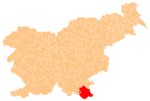
Pavičiči (pronounced [paˈʋiːtʃitʃi]) is a small village in the Municipality of Črnomelj in southeastern Slovenia. Until 2007, the area was part of the settlement of Zastava.[2] The village is part of the traditional region of White Carniola and is included in the Southeast Slovenia Statistical Region.[3]
References
[edit]- ^ "Rim, Črnomelj". Place Names. Statistical Office of the Republic of Slovenia. Retrieved 19 August 2012.
- ^ "Rim, Črnomelj". Stat.si: krajevna imena [Stat.si: Place Names] (in Slovenian). Statistical Office of the Republic of Slovenia. Retrieved 19 August 2013.
- ^ Črnomelj municipal site
External links
[edit]


