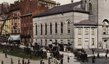
Park Street, Boston
Appearance
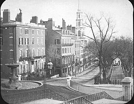
 Park Street, Boston, 19th-century Boston Common (at left), Massachusetts State House (at top) | |
| Location | Boston |
|---|---|
| South end | Tremont Street |
| North end | Beacon Street |
Park Street is a short but historic road in the center of Boston, Massachusetts. It begins at the top of Beacon Hill, at the intersection of Beacon Street, where it is lined up with the front of the Massachusetts State House. It then spills down the hill toward Tremont Street, with Boston Common to its west.[1]
History
[edit]Park Street was laid out in 1804, initially as Park Place, replacing the previous Sentry Street.[2]
In the 1880s, the feminist Woman's Journal was published on Park Street. Houghton Mifflin was also headquartered here beginning in the late 19th century.[3]
Gallery
[edit]-
Park St., c. 1815; Park Street Church (at right), Hancock mansion (in distance across Common, at upper left)
-
Park St., c. 1860, looking towards Tremont St.; Amory Ticknor house (on left, behind fountain)
-
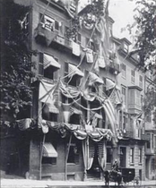
Union Club, Park St., 1875
-
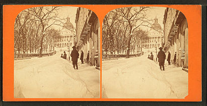
Winter scene, 19th century
-
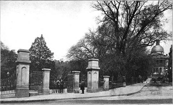
Park St. gate, Boston Common, 19th century
-
Amory Ticknor house, 1935, at corner of Beacon St. and Park St.
-
Corner of Park and Tremont Streets, Boston, 2008
-
Park Street looking from near the Massachusetts State House, 2008
-
1904 Park St Boston
See also
[edit]- Park Street District
- Boston Common
- The Massachusetts State House
- Park Street Church
- Park Street (MBTA station), the first subway station in the United States, is located at the corner of Park and Tremont Streets and is a major transfer point between the Red and Green rapid transit lines.
- No. 9 Park
- Amory-Ticknor House
- Union Club of Boston
- Fox 25 News studios, built to include the State House as its backdrop
- Paulist Center & Chapel
References
[edit]Wikimedia Commons has media related to Park Street (Boston, Massachusetts).
- ^ "Street Book - City of Boston".
- ^ "A Brief History of the Union Club". The Union Club of Boston. Archived from the original on 1 April 2012. Retrieved 4 October 2012.
- ^ Boston almanac and business directory, 1887, 1894. Boston register and business directory, 1921.
42°21′26.53″N 71°3′46.35″W / 42.3573694°N 71.0628750°W


