Panchawati
Appearance
Panchawati
पञ्चावती | |
|---|---|
| Coordinates: 26°55′N 86°31′E / 26.91°N 86.52°E | |
| Country | |
| Province | Province No. 1 |
| District | Udayapur |
| Rural Municipality | Udayapurgadhi |
| Population (1991) | |
• Total | 6,580 |
| Time zone | UTC+5:45 (Nepal Time) |
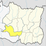
Panchawati is a village in, and headquarter of, Udayapurgadhi rural municipality in Udayapur District in Province No. 1 of south-eastern Nepal. At the time of the 1991 Nepal census it had a population of 6,580 people living in 1223 individual households.[1]
Panchawati was a village development committee before 2015. In 2015, when Nepal became a federal state, a total of 744 local administrative units were established. 8 such units were established in Udayapur District, including Udayapurgadhi. Panchawati was merged into Udayapurgadhi and established as its headquarter.
Udayapurgadhi was previously Headquarter of Udayapur District before 1972, when the headquarter was moved to Gaighat.[2]
References
[edit]- ^ "Nepal Census 2001". Nepal's Village Development Committees. Digital Himalaya. Retrieved 13 November 2008.
- ^ "उदयपुरको पुरानो सदमुकाम उदयपुरगढीको यस्तो छ ऐतिहासिक तथ्य". thahakhabar.com (in Nepali). 25 April 2017. Retrieved 9 February 2018.
वि.स. २०२८ सालभन्दा अगाडि उदयपुर जिल्लाको सदरमुकाम हालको पञ्चावती गाविसमा पर्ने त्यही उदयपुरगढीमा थियो। पछि सदरमुकाम गाईघाटमा सारिएको हो।
External links
[edit]


