Portal:Scottish islands
The Scottish Islands Portal
Welcome! — Fàilte! — Walcome!

Scotland has around 900 offshore islands, most of which are to be found in four main groups: Shetland, Orkney, and the Hebrides, sub-divided into the Inner Hebrides and Outer Hebrides. There are also clusters of islands in the Firth of Clyde, Firth of Forth, and Solway Firth, and numerous small islands within the many bodies of fresh water in Scotland including Loch Lomond and Loch Maree. The largest island is Lewis and Harris which extends to 2,179 square kilometres, and there are a further 200 islands which are greater than 40 hectares in area. Of the remainder, several such as Staffa and the Flannan Isles are well-known despite their small size. Some 94 Scottish islands are permanently inhabited, of which 89 are offshore islands. Between 2001 and 2011, Scottish island populations as a whole grew by 4% to 103,702.
The geology and geomorphology of the islands is varied. Some, such as Skye and Mull, are mountainous, while others like Tiree and Sanday are relatively low-lying. Many have bedrock made from ancient Archaean Lewisian Gneiss which was formed 3 billion years ago; Shapinsay and other Orkney islands are formed from Old Red Sandstone, which is 400 million years old; and others such as Rùm from more recent Tertiary volcanoes. Many of the islands are swept by strong tides, and the Corryvreckan tide race between Scarba and Jura is one of the largest whirlpools in the world. Other strong tides are to be found in the Pentland Firth between mainland Scotland and Orkney, and another example is the "Grey Dog" between Scarba and Lunga. (More on Scottish islands...)
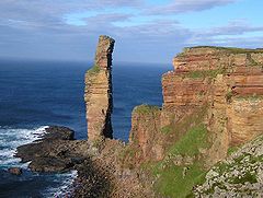
Selected picture
Selected island group
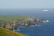
Shetland, also called the Shetland Islands, is an archipelago in Scotland lying between Orkney, the Faroe Islands, and Norway. It is the northernmost region of the United Kingdom.
The islands lie about 50 miles (80 kilometres) to the northeast of Orkney, 110 mi (170 km) from mainland Scotland and 140 mi (220 km) west of Norway. They form part of the border between the Atlantic Ocean to the west and the North Sea to the east. Their total area is 1,467 km2 (566 sq mi), and the population totalled 23,020 in 2022. The islands comprise the Shetland constituency of the Scottish Parliament. Shetland forms one of the 32 council areas of Scotland; the local authority is the Shetland Islands Council. The islands' administrative centre, largest settlement and only burgh is Lerwick, which has been the capital of Shetland since 1708, before which time the capital was Scalloway.
The archipelago has an oceanic climate, complex geology, rugged coastline, and many low, rolling hills. The largest island, known as "the Mainland", has an area of 373 sq mi (967 km2), and is the fifth-largest island in the British Isles. It is one of 16 inhabited islands in Shetland.
Humans have lived in Shetland since the Mesolithic period. Picts are known to have been the original inhabitants of the islands, before the Norse conquest and subsequent colonisation in the Early Middle Ages. From the 10th to 15th centuries, the islands formed part of the Kingdom of Norway. In 1472, the Parliament of Scotland absorbed the Lordship of Shetland into the Kingdom of Scotland, following the failure to pay a dowry promised to James III of Scotland by the family of his bride, Margaret of Denmark. After Scotland and England united in 1707 to form the Kingdom of Great Britain, trade between Shetland and continental Northern Europe decreased. The discovery of North Sea oil in the 1970s significantly boosted Shetland's economy, employment and public-sector revenues. Fishing has always been an important part of the islands' economy. (Full article...)
News
- 12 February: The BiFab construction yard at Arnish near Stornoway, Isle of Lewis, is purchased by InfraStrata.
- 11 February: Wild fires occur in Benbecula; and at Achmore and Sildinish in the Isle of Lewis; Horsaclete in Harris; Brevig in Barra; and Eubhal in North Uist.
- 19 January: Barra and Vatersay are put under tier-4 restrictions after an outbreak of Covid-19.
- 18 January: The Shetland Space Centre submits plans for a spaceport on Unst (proposed site pictured), Shetland, including three rocket launch pads.
- 8 January: Distilleries in Orkney and South Uist receive government grants to research ways of reducing their CO2 emissions.
- 4 January: After the UK leaves the European Union, the Northern Celt, an Irish fishing boat based out of Greencastle, County Donegal, is ordered to leave the 12-nautical-mile zone around Rockall by officers of Marine Scotland.
- 1 January: A total of 72 cases of Covid-19 are recorded in an ongoing outbreak in Shetland.
- 9 December: A review by a committee of MSPs into the commissioning and building of two new dual-fuel Caledonian MacBrayne ferries, MV Glen Sannox and "hull 802", criticises CMAL, Transport Scotland and the Scottish government, as well as the ship builders, Ferguson Marine.
- 3 December: North-east Lewis, Sea of the Hebrides and Shiant East Bank are designated Marine Protected Areas, while East Mainland Coast Shetland, Sound of Gigha, Coll and Tiree, Rùm, the west coast of the Outer Hebrides, and the waters off St Kilda and Foula are designated Special Protection Areas.
- 30 November: Michael Russell, MSP for Argyll and Bute, and David Stewart and John Finnie, MSPs for the Highlands and Islands region, will stand down at the 2021 election.
- 17 November: Phytophthora ramorum-infected larch trees in Arran are to be felled over a 543-acre area, to prevent the fungus-like pathogen from spreading.
- 4 November: The Scottish Wildlife Trust objects to a proposed salmon farm in the Marine Protected Area of Wester Ross, near Horse Island, Summer Isles, because of the potential impact on kelp forests and maerl beds.
Selected fauna
The Shetland Sheepdog, also known as the Sheltie, is a breed of herding dog that originated in the Shetland Islands of Scotland. It was formally recognized by the Kennel Club in 1909. It was originally called the Shetland Collie, but this caused controversy amongst Rough Collie breeders of the time, so the name was changed. It is a small dog, clever, vocal, willing to please, and trustworthy.
Like the Shetland pony, Shetland cattle, and the Shetland sheep, the Shetland Sheepdog is a hardy but diminutive breed developed to thrive amidst the harsh and meagre conditions of its native islands. While the Shetland still excels at herding, today it is often raised as a working dog or family pet.
The Shetland's origins are obscure, but it is not a direct descendant of the Rough Collie, which it largely resembles. Rather, the Shetland is a descendant of small specimens of the Scottish Collie and the King Charles Spaniel. They were originally a small mixed-breed dog, often only about 20 to 30 centimetres (8 to 12 inches) in height at the shoulder, and it is thought that the original Shetland herding dogs were of the Spitz type, and were crossed with Collies from mainland Britain. In the early 20th century, James Loggie added a small Rough Collie to the breeding stock, and helped establish the breed that would become the modern Shetland Sheepdog. (Full article...)
Selected history & culture article
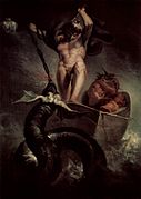
The stoor worm, or Mester Stoor Worm, was a gigantic evil sea serpent of Orcadian folklore, capable of contaminating plants and destroying animals and humans with its putrid breath. It is probably an Orkney variant of the Norse Jörmungandr, also known as the Midgard Serpent, or world serpent, and has been described as a sea dragon.
The king of one country threatened by the beast's arrival was advised to offer it a weekly sacrifice of seven virgins. In desperation, the king eventually issued a proclamation offering his kingdom, his daughter's hand in marriage, and a magic sword to anyone who could destroy the monster. Assipattle, the youngest son of a local farmer, defeated the creature; as it died its teeth fell out to become the islands of Orkney, Shetland and the Faroes, and its body became Iceland.
Similarities between Assipatle's defeat of the monster and other dragon-slayer tales, including Herakles' destruction of a sea monster to save Hesione, have been noted by several authors. It has been suggested that tales of this genre evolved during a period of enlightenment when human sacrifices to bestial divinities were beginning to be suppressed. (Full article...)
Selected island
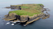
Staffa (Scottish Gaelic: Stafa, pronounced [ˈs̪t̪afa], from the Old Norse for stave or pillar island) is an island of the Inner Hebrides in Argyll and Bute, Scotland. The Vikings gave it this name as its columnar basalt reminded them of their houses, which were built from vertically placed tree-logs.
Staffa lies about 10 kilometres (6 miles) west of the Isle of Mull; its area is 33 hectares (82 acres) and the highest point is 42 metres (138 feet) above sea level.
The island came to prominence in the late 18th century after a visit by Sir Joseph Banks. He and his fellow-travellers extolled the natural beauty of the basalt columns in general and of the island's main sea cavern, which Banks renamed 'Fingal's Cave'. Their visit was followed by those of many other prominent personalities throughout the next two centuries, including Queen Victoria and Felix Mendelssohn. The latter's Hebrides Overture brought further fame to the island, which was by then uninhabited. It is now in the care of the National Trust for Scotland. (Full article...)
Did you know?
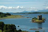
- ...that Hinba, an island in Scotland of unknown location (possible location pictured), was the site of a small monastery associated with the church of St Columba on Iona?
- ... that the German dreadnought battleship SMS Kaiserin was the first battleship to pass through the Kaiser Wilhelm Canal in July 1914, days before the outbreak of World War I?
- ...that Bridei III's victory in the Battle of Dunnichen led to the expulsion of Northumbrians from southern Pictland?
- ... that ever since coming between neighbours, Funzie Girt has run almost the length of a Scottish island?
Selected portrait
Selected geography article
The Cuillin (Scottish Gaelic: An Cuiltheann) is a range of mostly jagged rocky mountains on the Isle of Skye in Scotland. The main Cuillin ridge is also called the Black Cuillin to distinguish it from the Red Cuillin (na Beanntan Dearga), which lie to the east of Glen Sligachan.
The peaks of the Black Cuillin are mainly composed of gabbro, a very rough igneous rock which provides a superb grip for mountaineers; and basalt, which can be very slippery when wet. The rocks forming the ridge of the Black Cuillin (and outliers such Blà Bheinn) are dark, particularly in the shade, but when in sunlight the Black Cuillin can appear grey to brown. The main ridge forms a narrow crest, with steep cliffs and scree slopes. The ridge is about 14 kilometres (8+1⁄2 miles) long (from Gars-bheinn in the south to Sgùrr nan Gillean in the northeast), and curves in an irregular semi-circle around Loch Coruisk, which lies at the heart of the range. The highest point of the Cuillin, and of the Isle of Skye, is Sgùrr Alasdair in the Black Cuillin at 992 m (3,255 ft).
The Red Cuillin are mainly composed of granite, which is paler than the gabbro (with a reddish tinge from some angles in some lights) and has weathered into more rounded hills with vegetation cover to summit level and long scree slopes on their flanks. These hills are lower and, being less rocky, have fewer scrambles or climbs. The highest point of the red hills is Glamaig at 775 m (2,543 ft), one of only two Corbetts on Skye (the other being Garbh-bheinn, part of the small group of gabbro outliers surrounding Blà Bheinn).
The scenic beauty of the Cuillin has led to it being designated a national scenic area, one of forty such areas in Scotland. A Scottish Natural Heritage review of the special qualities of the Cuillin stated:
(Full article...)The mountains rise up dramatically from the sea creating formidable, enclosed sea lochs, with the absence of foothills enhancing their vast scale. Many iconic views of Scotland are centred here, whether Sgurr nan Gillean soaring above Sligachan, Loch Scavaig and the Cuillin ridge from Elgol, or Bla Bheinn above Torrin.
— Scottish Natural Heritage
Selected biography

Patrick Stewart, 2nd Earl of Orkney, known as Black Patie, had control of Orkney in 1594 at the time of Balfour's trial. Patie was convinced that his younger brothers, especially John Stewart, Earl of Carrick, were plotting to kill him. Patie discovered poison in the possession of one of John's servants, Thomas Paplay, who after being tortured for eleven days confessed and implicated Balfour among his co-conspirators.
Although Paplay retracted his confession just before his execution, Balfour and her family were transported to Kirkwall, where they were tortured until a confession was extracted. Balfour was tried, found guilty of witchcraft, and sentenced to death. Just as Paplay had done, Balfour retracted her confession immediately before her execution on 16 December 1594, publicly proclaiming her innocence and detailing the tortures carried out on her and members of her family. She was executed at Gallow Ha' in Kirkwall on 16 December 1594. (Full article...)
Related portals
Selected panorama
Topics
Categories
The main category is Islands of Scotland, with subcategories

Things you can do
- Add new articles to the project by placing {{WPSI|class=|importance=}} on the talk page
- Add a link to the portal in the "See also" section of relevant articles with {{Portal|Scottish islands}}
- Take requested photographs or create requested pages, including Prehistoric Hebrides, Trialabreac, Dog Isle...
- Expand a Scottish Islands stub into a full article, adding images, citations, references and infoboxes; did you know that if you expand one 5x, you can nominate it for Did You Know?
- Improve one of the highest priority articles, including Mull, Bute, North & South Uist, Columba, Highland Clearances, Sorley MacLean, St Magnus Cathedral...
- Follow these hints to improve a B-class article and nominate it for Good Article

- Suggest articles, pictures, interesting facts, events and news to be featured here on the portal
Wikiproject
Associated Wikimedia
The following Wikimedia Foundation sister projects provide more on this subject:
-
Commons
Free media repository -
Wikibooks
Free textbooks and manuals -
Wikidata
Free knowledge base -
Wikinews
Free-content news -
Wikiquote
Collection of quotations -
Wikisource
Free-content library -
Wikiversity
Free learning tools -
Wikivoyage
Free travel guide -
Wiktionary
Dictionary and thesaurus

