Osztopán
Appearance
Osztopán
Stupan (in Croatian) | |
|---|---|
Village | |
 Tallián Mansion in Osztopán | |
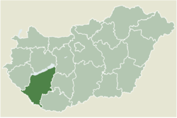
 Location of Somogy county in Hungary | |
| Coordinates: 46°31′13″N 17°40′14″E / 46.52032°N 17.67068°E | |
| Country | |
| Region | Southern Transdanubia |
| County | Somogy |
| District | Kaposvár |
| RC Diocese | Kaposvár |
| Area | |
• Total | 22.83 km2 (8.81 sq mi) |
| Population (2017) | |
• Total | 824[1] |
| Demonym | osztopáni |
| Time zone | UTC+1 (CET) |
| • Summer (DST) | UTC+2 (CEST) |
| Postal code | 7444 |
| Area code | (+36) 82 |
| NUTS 3 code | HU232 |
| MP | József Attila Móring (KDNP) |
| Website | Osztopán Online |
Osztopán (Croatian: Stupan) is a village in Somogy county, Hungary.
Etymology
[edit]The name comes from the Slavic Stupan[2][3] derived from the Proto-Slavic stem stǫp- with several meanings and possible etymologies (i.e. stǫpa/stupa: trapping pit,[2] see also the etymology of Stupava).
History
[edit]According to László Szita the settlement was completely Hungarian in the 18th century.[4]
Highway bridge bombed by 97th BG on 30 June 1944 when primary target Blechammer oil refinery was overcast.
Culture
[edit]The Hungarian folk song Osztopáni malomárok was collected in Osztopán in 1949 by Ferenc Gönczi.
References
[edit]- ^ Osztopán, KSH
- ^ a b Stanislav, Ján (2004). Slovenský juh v stredoveku II (in Slovak). Slovenské literárne centrum. p. 325. ISBN 80-88878-89-6.
- ^ Kiss, Lajos (1978). Földrajzi nevek etimológiai szótára (in Hungarian). Budapest: Akadémiai. p. 488.
- ^ László Szita : Somogy megyei nemzetiségek településtörténete a XVIII-XIX. században - Somogyi Almanach 52. (Kaposvár, 1993)
External links
[edit]


