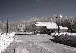
Orient–Fosterville Border Crossing
| Orient–Fosterville Border Crossing | |
|---|---|
 The Canada Border Inspection Station at Fosterville, New Brunswick | |
| Location | |
| Country | United States; Canada |
| Location |
|
| Coordinates | 45°49′00″N 67°46′50″W / 45.81674305290214°N 67.78050810098648°W |
| Details | |
| Opened | 1930 |
| Phone | US: (207) 448-2427 Canada: (506) 894-2281 |
| US Hours | All times Eastern December 1-May 14: 7AM-5PM May 15-November 30: 7AM-11PM |
| Canadian Hours | All times Atlantic May 15-November 30: 8AM-1200AM December 1-May 14: 9AM-5PM Sun-Fri 8AM-12AM Sat Commercial traffic year-round: 9AM-5PM |
| Website | |
U.S. Inspection Station-Orient, Maine | |
| MPS | U.S. Border Inspection Stations MPS |
| NRHP reference No. | 14000557 |
| Added to NRHP | September 10, 2014 |
The Orient–Fosterville Border Crossing is an international border crossing between the towns of Orient, Maine, United States and Fosterville, New Brunswick, Canada on the Canada–US border. At this crossing, the United States is still operating the original border station built in 1937, which was listed on the National Register of Historic Places in 2014. Canada built its current border station in 1986. This section of the border is a series of lakes and streams that supply the St Croix River. The original bridge connecting Orient with Fosterville was said to be the shortest international bridge between the US and Canada.[1]
Canadian facilities
[edit]This section needs expansion. You can help by adding to it. (July 2015) |
The Canadian government built a border station here in about 1930. The current station was built in 1986.
The Canadian station handles about 30 cars every day.[2]
United States facilities
[edit]
The United States facility is located on the north side of Boundary Road. The main building is a 1+1⁄2-story brick-faced Colonial Revival structure, with a side-gable roof and a projecting one-lane hip-roofed porte-cochere. The porte-cochere is supported by Classical Revival squared columns, with matching pilasters at the building front. Stylistically similar wood-frame single-story wings extend the building to either side; that on the left houses restrooms, that on the right offices. The interior of the main building is symmetrically organized, with customs on one side and immigration on the other. A small garage, dating to the same period as the main building, stands to the northwest.[3]
Prior to the construction of this station, customs and immigration formalities would have taken place in the nearest town. With the advent of increased automobile traffic in the 1920s, as well as the need to interdict the movement of contraband liquor due to Prohibition, the federal government realized the need for border stations where immigration formalities and vehicle inspections could be performed close to the border, and consequently planned the construction of a series of such stations. This building, built in 1937, is the least-altered of Maine's surviving early border stations. It was built to a standard "Type 1" plan, one of three built on the Canada–US border, and is the only one of those still in use in Maine. Others of this style are still in operation in other states, including Morses Line, Vermont, and Alburg Springs, Vermont.[3]
See also
[edit]- List of Canada–United States border crossings
- National Register of Historic Places listings in Aroostook County, Maine
References
[edit]- ^ "ChipLakeNEWS InfoSheet". April 21, 2003. Retrieved August 22, 2014.
- ^ "Orient and Fosterville Ports | ezbordercrossing". www.ezbordercrossing.com. Retrieved July 19, 2022.
- ^ a b Paul, Daniel; Starzak, Richard (2011). NRHP nomination for US Border Station - Limestone, Maine; available by request from the Maine SHPO
- Canada–United States border crossings
- Transportation buildings and structures in Aroostook County, Maine
- National Register of Historic Places in Maine
- Transport in York County, New Brunswick
- Buildings and structures in York County, New Brunswick
- National Register of Historic Places in Aroostook County, Maine
- 1930 establishments in Maine
- 1930 establishments in New Brunswick
