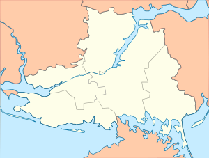
Novotroitske, Kherson Oblast
You can help expand this article with text translated from the corresponding article in Ukrainian. (July 2022) Click [show] for important translation instructions.
|
Novotroitske
Новотроїцьке | |
|---|---|
| Coordinates: 46°21′N 34°20′E / 46.350°N 34.333°E | |
| Country | |
| Oblast | Kherson Oblast |
| Raion | Henichesk Raion |
| Hromada | Novotroitske settlement hromada |
| Founded | 18?? (Novotroitske) 1816 (Velykyi Sara Bulat) |
| Area | |
| • Total | 122.3 km2 (47.2 sq mi) |
| Elevation | 22 m (72 ft) |
| Population (2022) | |
| • Total | |
| • Density | 88.5/km2 (229/sq mi) |
| Time zone | UTC+2 (EET) |
| • Summer (DST) | UTC+3 (EEST) |
| Postal code | 75300 |
| Area code | +380 5548 |
Novotroitske (Ukrainian: Новотроїцьке) is a rural settlement in Henichesk Raion, Kherson Oblast, southern Ukraine. It hosts the administration of the Novotroitske settlement hromada, one of the hromadas of Ukraine.[1] It had a population of 10,535 (2022 estimate).[2]
History
[edit]Until 18 July 2020, Novotroitske was the administrative center of Novotroitske Raion. The raion was abolished in July 2020 as part of the administrative reform of Ukraine, which reduced the number of raions of Kherson Oblast to five. The area of Novotroitske Raion was merged into Henichesk Raion.[3][4]
Russo-Ukrainian war
[edit]Novotroitske was captured by Russian ground forces on the first day of the Russian Invasion of Ukraine phase of the Russo-Ukrainian War when they crossed the nearby border of the de facto Republic of Crimea. A large column of Russian military vehicles drove through the village.[5]
In March 2022, Ukrainian media reported that citizens held a peaceful rally against the Russian army occupation in the settlement.[6]
In 2023, Ukraine's representative of the Kherson Oblast council, Serhiy Khlan, reported that Ukrainian Armed Forces had conducted a missile strike at a village in the district.[7]
Until 26 January 2024, Novotroitske was designated urban-type settlement. On this day, a new law entered into force which abolished this status, and Novotroitske became a rural settlement.[8]
See also
[edit]References
[edit]- ^ "Новотроицкая громада" (in Russian). Портал об'єднаних громад України.
- ^ Чисельність наявного населення України на 1 січня 2022 [Number of Present Population of Ukraine, as of January 1, 2022] (PDF) (in Ukrainian and English). Kyiv: State Statistics Service of Ukraine. Archived (PDF) from the original on 4 July 2022.
- ^ "Про утворення та ліквідацію районів. Постанова Верховної Ради України № 807-ІХ". Голос України (in Ukrainian). 2020-07-18. Retrieved 2020-10-03.
- ^ "Нові райони: карти + склад" (in Ukrainian). Міністерство розвитку громад та територій України.
- ^ Таміла Івановна (2022-02-24). "На Херсонщині спостерігають активність російських військ" (in Ukrainian). Suspilne. Retrieved 2024-02-27.
- ^ "Kherson region: people sing Ukrainian anthem at rally in Novotroitske". Ukrainska Pravda. Retrieved 2024-02-25.
- ^ Staff, Euromaidan Press (2023-03-18). "Ukraine reportedly conducted a missile strike almost 100 km deep in Russia's defense, destroying a Russian base". Euromaidan Press. Retrieved 2024-02-25.
- ^ "Что изменится в Украине с 1 января". glavnoe.in.ua (in Russian). 1 January 2024.
External links
[edit]


