Now Kandeh
Appearance
(Redirected from Nokandeh)
Now Kandeh
Persian: نوکنده | |
|---|---|
City | |
 | |
| Coordinates: 36°44′16″N 53°54′33″E / 36.73778°N 53.90917°E[1] | |
| Country | Iran |
| Province | Golestan |
| County | Bandar-e Gaz |
| District | Now Kandeh |
| Population (2016)[2] | |
| • Total | 6,650 |
| Time zone | UTC+3:30 (IRST) |
| Now Kandeh at GEOnet Names Server | |
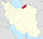
Now Kandeh (Persian: نوکنده)[a] is a city in, and the capital of, Now Kandeh District of Bandar-e Gaz County, Golestan province, Iran.[4] As a village, it was the capital of Anzan Rural District[5][b] until its capital was transferred to the village of Gaz-e Gharbi. It was then the administrative center for Banafsh Tappeh Rural District[4] until its capital was transferred to the village of Jafa Kandeh.[6]
Demographics
[edit]Language
[edit]The people of Now Kandeh speak the Mazandarani language.[7]
Population
[edit]At the time of the 2006 National Census, the city's population was 7,601 in 2,058 households.[8] The following census in 2011 counted 7,155 people in 2,220 households.[9] The 2016 census measured the population of the city as 6,650 people in 2,316 households.[2]
Notable people
[edit]- Ahmad Mazani, Iranian cleric and politician
- Mahlagha Mallah, nearby environmental activist[10]
See also
[edit]Notes
[edit]- ^ Also romanized as Naukandeh; also known as Nokandeh[3]
- ^ Renamed Anzan-e Gharbi Rural District
References
[edit]- ^ OpenStreetMap contributors (16 October 2024). "Now Kandeh, Bandar-e Gaz County" (Map). OpenStreetMap (in Persian). Retrieved 16 October 2024.
- ^ a b Census of the Islamic Republic of Iran, 1395 (2016): Golestan Province. amar.org.ir (Report) (in Persian). The Statistical Center of Iran. Archived from the original (Excel) on 29 March 2019. Retrieved 19 December 2022.
- ^ Now Kandeh can be found at GEOnet Names Server, at this link, by opening the Advanced Search box, entering "-3077239" in the "Unique Feature Id" form, and clicking on "Search Database".
- ^ a b Habibi, Hassan (7 June 1394) [Approved 29 April 1376]. Reforms and changes of national divisions in Mazandaran province. rc.majlis.ir (Report) (in Persian). Ministry of the Interior, Political-Defense Commission of the Government Board. Proposal 1.4.42.4803; Notification 62229/18390K. Archived from the original on 28 May 2015. Retrieved 14 February 2014 – via Islamic Parliament Research Center.
- ^ Mousavi, Mirhossein (c. 2024) [4 October 1366]. Creation and establishment of four rural districts including villages, farms and places in Kordkuy County under Mazandaran province. lamtakam.com (Report) (in Persian). Ministry of the Interior, Council of Ministers. Notification 1364.33.1.5.53. Archived from the original on 14 February 2024. Retrieved 14 February 2024 – via Lam ta Kam.
- ^ "Four new cities were added to the map of the country's divisions; with some changes in the geographical map of three provinces". dolat.ir (in Persian). Ministry of the Interior, Political and Defense Commission. 28 January 2013. Archived from the original on 16 March 2017. Retrieved 9 November 2023 – via Secretariat of the Government Information Council.
- ^ Borjian, Habib (2004). "Māzandarān: Language and People". Iran & the Caucasus. 8 (2). Brill: 295. doi:10.1163/1573384043076045. JSTOR 4030997.
- ^ Census of the Islamic Republic of Iran, 1385 (2006): Golestan Province. amar.org.ir (Report) (in Persian). The Statistical Center of Iran. Archived from the original (Excel) on 20 September 2011. Retrieved 25 September 2022.
- ^ Census of the Islamic Republic of Iran, 1390 (2011): Golestan Province. irandataportal.syr.edu (Report) (in Persian). The Statistical Center of Iran. Archived from the original (Excel) on 17 January 2023. Retrieved 19 December 2022 – via Iran Data Portal, Syracuse University.
- ^ "صدسالگی "مهلقا ملاح"". 11 December 2020. Archived from the original on 11 December 2020. Retrieved 11 December 2020.


