Nechasalyan Rural Municipality
Nechasalyan Rural Municipality
नेचासल्यान गाउँपालिका | |
|---|---|
 Salyan Fedi ricefield and Dyamde ricefield | |
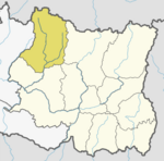
 Necha-Salyan Gaupalika in map of Solukhumbu | |
| Coordinates: 27°21′36″N 86°39′36″E / 27.3600°N 86.6600°E | |
| country | Nepal |
| Province | Province No. 1 |
| District | Solukhumbu District |
| Total wards | 5 |
| Established | 10 March 2017 |
| Government | |
| • Type | Rural council |
| • Chairperson | Dhanraj Rai (NC) |
| • Vice-chairperson | Bina Rai (NC) |
| • Executive Officer | Bishal Ghimire |
| Area | |
| • Total | 94.49 km2 (36.48 sq mi) |
| Population (2017) | |
| • Total | 16,129 |
| • Density | 170/km2 (440/sq mi) |
| Time zone | UTC+5:45 (Nepal Standard Time) |
| Area code | +977-038 |
| Headquarters | Necha Betghari |
| Website | nechasalyanmun |
Nechasalyan (Nepali: नेचासल्यान गाउँपालिका) is a rural municipality, or gaunpalika, located in Solukhumbu District, Province No. 1, Nepal. Solukhumbu has eight municipalities in all; one is an urban municipality (or nagarpalika) and the other seven are rural municipalities.[1]
According to the Ministry of Federal Affairs and Local Development, Nechasalyan has an area of 94.49 square kilometres (36.48 sq mi) and the total population of the municipality is 16,129 as of the Census of Nepal 2011.[2]
Nechasalyan was created by the merger of three previously separate village development committees (or VDCs): Salyan, Necha Betghari, and Necha Batase. This merger was a result of the new Constitution of Nepal 2015. The Ministry of Federal Affairs and Local Development replaced all the old VDCs and municipalities, replacing them with 753 new local-level bodies (Municipality).[2][1]
This rural municipality is subdivided into five wards, with its headquarters in Ward No. 3 in Necha Betghari.[2]
References
[edit]- ^ a b "हेर्नुहोस्, तपाईं कुन गाउँपालिका वा नगरपालिकामा पर्नुभयो?". setopati. Archived from the original on 12 March 2017. Retrieved 11 March 2017.
- ^ a b c "स्थानीय तहहरुको विवरण". www.mofald.gov.np/en. MoFALD. Archived from the original on 31 August 2018. Retrieved 20 April 2018.
External links
[edit]


