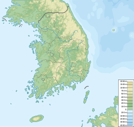
Namamsan
Appearance
| Namamsan | |
|---|---|
| Korean name | |
| Hangul | 남암산 |
| Hanja | |
| Revised Romanization | Nam-amsan |
| McCune–Reischauer | Namamsan |
| Highest point | |
| Elevation | 543 m (1,781 ft) |
| Coordinates | 35°30′47″N 129°13′01″E / 35.513°N 129.217°E |
| Geography | |
| Location | Ulsan, South Korea |
Namamsan is a mountain located in Ulju county, Ulsan, South Korea. It has an elevation of 543 m (1,781 ft).[1]
See also
[edit]- Geography of Korea
- List of mountains in Korea
- List of mountains by elevation
- Mountain portal
- South Korea portal
References
[edit]- ^ "근교산&그너머 <421> 울산 문수~남암산". 국제신문 (Gukje Newspaper). 17 February 2005. Retrieved 11 July 2013.

