Nádudvar
Appearance
Nádudvar | |
|---|---|
| Coordinates: 47°25′N 21°10′E / 47.417°N 21.167°E | |
| Country | |
| County | Hajdú-Bihar |
| District | Hajdúszoboszló |
| Area | |
• Total | 294.99 km2 (113.90 sq mi) |
| Population (2019) | |
• Total | 8,472 |
| • Density | 29/km2 (74/sq mi) |
| Time zone | UTC+1 (CET) |
| • Summer (DST) | UTC+2 (CEST) |
| Postal code | 4181 |
| Area code | (+36) 54 |
| Website | www |
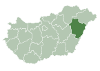
Nádudvar is a town in Hajdú-Bihar county, in the Northern Great Plain region of eastern Hungary.
Geography
[edit]It covers an area of 294.99 km2 (114 sq mi) and has a population of 11,472 people (2019).
Twin towns – sister cities
[edit]References
[edit]- ^ "Testvérvárosok". nadudvar.hu (in Hungarian). Nádudvar. Retrieved 2021-04-28.
External links
[edit]Wikimedia Commons has media related to Nádudvar.
- Official website in Hungarian, English and German
47°25′N 21°10′E / 47.417°N 21.167°E


