Mtwara-Mikindani District, Mtwara
Mtwara-Mikindani | |
|---|---|
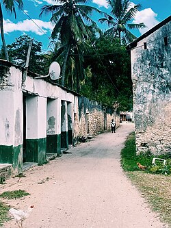
 Street Scene in Magengeni ward, Mikindani | |
| Nickname: "Mtwara's soul" | |
 Mtwara Mikindani in Mtwara Region | |
| Country | |
| Region | Mtwara Region |
| District | Mtwara-Mikindani District |
| Capital | Mtwara |
| Area | |
| • Total | 170 km2 (70 sq mi) |
| Elevation | 0 m (0 ft) |
| Highest elevation | 111 m (364 ft) |
| Population (2016) | |
| • Total | 113,732 |
| • Density | 670/km2 (1,700/sq mi) |
| Demonym | Mtwara-Mikindanian |
| Time zone | EAT |
| Tanzanian Postal Code | 631** |
| Area code | 023 |
| Website | District Website |
Mtwara Mikindani Municipal District Council is one of eight regional councils of the Mtwara Region in Tanzania. It is bordered to the north by the Lindi Region, to the east by the Indian Ocean and to the south and west by the Mtwara District. In 2016, the municipality has a total population of 113,732 .
Geography
[edit]The district covers an area of 170 km2 (66 sq mi),[1] and has an average elevation of 106 m (348 ft) from sea level to 130 m (430 ft) on the first edge of the Makonde Plateau at the site of the new airport.The district is home to the following islands; Mongo Island and Mwanahawaja Island both in the Mnazi-bay Ruvuma Marine Park[2]: 1 [3][4]
Wards
[edit]The Mtwara Urban District is administratively its divided into 2 divisions - Mtwara Urban and Mikindani Division - and has 15 wards, 185 neighborhoods, 6 villages and 27 hamlets. Mtwara division is primarily the city and is urban while Mikindani is a small historic colonial town.
Mtwara Division (Population 2016)[5]: 7
|
|
Mikindani Division (Population 2016)[5]: 7
Demographics
[edit]
In 2016 the population was 113,732 from 108,299 in 2012. The people of Mtwara Mikindani are primarily Wamakonde at around 75%, with also Wamwera, Wayao, and Wamakua. Because of the discovery of significant oil and gas in the area, many from other areas of Tanzania are moving to the city creating making it much more diverse today.[6]: 87 [5]: 7 [2]: 4
Governance
[edit]Mtwara Mikindani is the only municipal council of the Mtwara Region, with the three town councils of Masasi Town, Nanyamba Town and Newala Town. The other 5 being the rural district councils of Masasi District, Mtwara District, Nanyumbu District, Newala District, and Tandahimba District.[7]: 13–14
The current mayor is Shadida Ally Ndile, and cirrent city director is Emmanuel H. Mwaigobeko.[8]
Infrastructure
[edit]
Currently the Mtwara Development Corridor is being built to connect the Mtwara Port, with Malawi, Mozambique, and Zambia, through the Mtwara Region.[9]
Roads
[edit]Nanyamba has a road system of 334.96 km (208.13 mi), of which 103.72 km (64.45 mi) are collector roads, and 241.52 km (150.07 mi) are feeder roads.[7]: 33
Air
[edit]The district will be served by the new Mtwara International Airport. The airport is currently 92 per cent complete.[10]
Communications
[edit]The entire district has cell coverage and access to landlines, postage, internet, and over the air media of radio and television. The postal codes are designated after 631xx [2]: 89–90 [11]
References
[edit]- ^ "Tanzania: Coastal Tanzania (Districts and Wards) – Population Statistics, Charts and Map".
- ^ a b c Mwaigobeko, Kanali Emanuel H.; Mwanichisye, Geofrey I. (July 2018). Mtwara Mikindani Strategic Plan 2018 (PDF). mtwaramikindanimc.go.tz (Report). Mtwara, Tanzania: Mtwara Municipal Council. Archived (PDF) from the original on 25 June 2022. Retrieved 17 July 2022.
- ^ Arnett, Daniel. "Naliendele, Mtwara Urban, Tanzania". Elevation Map. Retrieved 5 July 2022.
- ^ "Mtwara-Mikindani District Elevation".
- ^ a b c 2016 Makadirio ya Idadi ya Watu katika Majimbo ya Uchaguzi kwa Mwaka 2016, Tanzania Bara [Population Estimates in Administrative Areas for the Year 2016, Mainland Tanzania] (PDF) (Report) (in Swahili). Dar es Salaam, Tanzania: National Bureau of Statistics. 1 April 2016. Archived (PDF) from the original on 27 December 2021. Retrieved 3 July 2022.
- ^ 2012 Population and Housing Census - Population Distribution by Administrative Areas (PDF) (Report). Dar es Salaam, Tanzania: National Bureau of Statistics. 1 March 2013. Archived (PDF) from the original on 26 March 2022. Retrieved 3 July 2022.
- ^ a b Mtwara Region Investement Guide (PDF). mtwara.go.tz (Report). Mtwara: Mtwara Region. 2019. Archived (PDF) from the original on 4 July 2022. Retrieved 16 July 2022.
- ^ "Halmashauri ya Mji Nanyamba". mtwaramikindanimc.go.tz (in Swahili). Mtwara, Tanzania: Manispaa ya Mtwara Mikindani. Archived from the original on 16 July 2022. Retrieved 16 July 2022.
- ^ Kpodo, Kwasi (23 September 2021). "Tanzania: African Development Fund approves $116 million loan to upgrade southern road corridor". afdb.org. Dodoma, Tanzania: African Development Bank. Archived from the original on 23 September 2021. Retrieved 16 July 2022.
- ^ Jumbe, Mwanamkasi (15 July 2022). "Payment delays cost government Sh1 billion in Mtwara airport". The Citizen (Tanzania). Dar es Salaam, Tanzania: Mwananchi Communications. Archived from the original on 16 July 2022. Retrieved 16 July 2022.
- ^ Mtwara Postcodes (PDF). tcra.go.tz (Report). Dodoma, Tanzania: Mamlaka ya Mawasiliano Tanzania. Archived (PDF) from the original on 25 June 2022. Retrieved 17 July 2022.
