Mount Wright (Alaska)
| Mount Wright | |
|---|---|
 Mount Wright from southwest | |
| Highest point | |
| Elevation | 5,054 feet (1,540 m)[1] |
| Prominence | 1,850 feet (560 m)[2] |
| Parent peak | Mount Case |
| Listing | Mountains of Alaska |
| Coordinates | 58°47′52″N 136°01′38″W / 58.7976627°N 136.0271834°W[3] |
| Geography | |
| Location | Glacier Bay National Park and Preserve, Alaska, United States |
| Parent range | Alsek Ranges Saint Elias Mountains |
| Topo map | USGS Mount Fairweather D-1[3] |
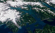
Mount Wright is a 5,054-foot (1,540 m) mountain located in the eastern Alaskan panhandle, on the east side of Muir Inlet, just north of Glacier Bay within Glacier Bay National Park and Preserve.
Location
[edit]Mount Wright is south of Adams Inlet, Dirt Gulch, and Dirt Glacier, to the east of Garforth Island in Muir Inlet, west of White Glacier, and the Chilkat Range[4] and 52 miles (84 km) northwest of Hoonah, Saint Elias Mountains.
History
[edit]Mount Wright was named by Dr. Harry Fielding Reid in 1891 after George Frederick Wright who spent some time in the Glacier Bay area in 1886. Forty-three miles to the west is another mountain also called Mount Wright.[3]

Climate
[edit]Based on the Köppen climate classification, Mount Wright has a subarctic climate (Dfc) with cold, snowy winters, and mild summers.[5] Temperatures can drop below −20 °C with wind chill factors below −30 °C. Precipitation runoff from the mountain drains into Glacier Bay Basin.
Fauna
[edit]The area has a high population of mountain goats.[6]
References
[edit]- ^ "Dirt Glacier". Alaska Guide. Retrieved 2019-08-07.
- ^ "Mount Wright, Alaska". Peakbagger.com. Retrieved 2019-08-07.
- ^ a b c "Feature Detail Report for: Mount Wright". GNIS. Retrieved 2019-08-07.
- ^ "Dirt Glacier". Mapcarta. Retrieved 2019-08-07.
- ^ Peel, M. C.; Finlayson, B. L. & McMahon, T. A. (2007). "Updated world map of the Köppen−Geiger climate classification". Hydrol. Earth Syst. Sci. 11. ISSN 1027-5606.
- ^ DuFresne, Jim (1987). Glacier Bay National Park: A Backcountry Guide to the Glaciers and Beyond. The Mountaineers Books. p. 61. ISBN 9780898861327. Retrieved 2019-08-07.

External links
[edit]- Weather forecast: Mount Wright

