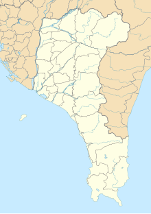
Mount Nanren Ecological Reserve Area
Appearance
| Mount Nanren Ecological Reserve Area Chinese: 南仁山生態保護區 | |
|---|---|
 | |
| Map | |
| Geography | |
| Location | Manzhou, Pingtung County, Taiwan |
| Coordinates | 22°05′14.8″N 120°51′13.0″E / 22.087444°N 120.853611°E |
| Area | 5,800 hectares |
| Administration | |
| Established | 1995 |
Mount Nanren Ecological Reserve Area (traditional Chinese: 南仁山生態保護區; simplified Chinese: 南仁山生态保护区; pinyin: Nánrén Shān Shēngtài Bǎohùqū) is a nature reserve in Kenting National Park, Manzhou Township, Pingtung County, Taiwan.
History
[edit]The reserve was established in 1995. The reserve was closed from May until end of 2008.[1]
Geology
[edit]The reserve spans over an area of 5,800 hectares. It features three lakes, which are the main water body, Nanren Lake and Yilan Lake.[2][3][4]
See also
[edit]References
[edit]- ^ "Two Kenting National Park ecological protected areas to close in May, 2008". Construction and Planning Agency, Ministry of the Interior (CPAM). Retrieved 24 August 2021.
- ^ "Nanrenshan Ecological Reserve Area". roundTAIWANround. Retrieved 24 August 2021.
- ^ "Nanren Lake Important Wetland". Taiwan's Wetland Ramsar Citizen. 18 April 2019. Retrieved 24 August 2021.
- ^ Cottenie, Tyler (19 February 2021). "Kenting's hidden gems". Taipei Times. Retrieved 24 August 2021.
Wikimedia Commons has media related to Mount Nanren Ecological Reserve Area.

