Mount Lymburner
Appearance


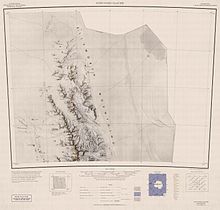
Mount Lymburner (77°26′S 86°30′W / 77.433°S 86.500°W) is a mountain, 1,940 metres (6,360 ft) high, standing 4 nautical miles (7 km) west-northwest of Mount Weems near the north end of the Sentinel Range in the Ellsworth Mountains of Antarctica. It was discovered by Lincoln Ellsworth on his trans-Antarctic flight of November 23, 1935, and was named by the Advisory Committee on Antarctic Names for J.H. Lymburner, an assistant pilot on Ellsworth's expedition.[1]
See also
[edit]References
[edit]- ^ "Mount Lymburner". Geographic Names Information System. United States Geological Survey, United States Department of the Interior. Retrieved 12 July 2013.
![]() This article incorporates public domain material from "Mount Lymburner". Geographic Names Information System. United States Geological Survey.
This article incorporates public domain material from "Mount Lymburner". Geographic Names Information System. United States Geological Survey.

